Langeland

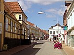
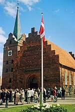
Langeland (Danish: [ˈlɑŋəˌlænˀ] (listen), lit. 'Long land') is a Danish island located between the Great Belt and Bay of Kiel. The island measures 285 km2 (c. 110 square miles) and, as of 1 January 2018, has a population of 12,446. The island produces grain and is known as a recreational and wellness tourism area. A bridge connects it to Tåsinge via Siø – a small island with a population of approximately 20 – and the main island of Funen (to the northwest). There are connections by car ferry to the islands of Lolland, Ærø, and Strynø. Rudkøbing, the island's largest town, is the birthplace of famous physicist and chemist Hans Christian Ørsted, his brother, Anders Sandøe Ørsted, a former Danish prime minister, and their nephew, botanist Anders Sandøe Ørsted. Administratively, Langeland and several smaller islands around it form the Municipality of Langeland, the most populous of them being Strynø.
Excerpt from the Wikipedia article Langeland (License: CC BY-SA 3.0, Authors, Images).Langeland
Skrøbelev Hedevej, Langeland Municipality
Geographical coordinates (GPS) Address Nearby Places Show on map
Geographical coordinates (GPS)
| Latitude | Longitude |
|---|---|
| N 54.916666666667 ° | E 10.75 ° |
Address
Skrøbelev Hedevej
Skrøbelev Hedevej
5900 Langeland Municipality
Region of Southern Denmark, Denmark
Open on Google Maps


