place

Sachsenburg concentration camp

Buildings and structures in SaxonyFrankenberg, SaxonyNazi Germany stubsNazi concentration camps in GermanySaxony building and structure stubs
26175 Sachsenburg 1933 Blick auf Sachsenburg Brück & Sohn Kunstverlag

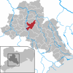
Sachsenburg was a Nazi concentration camp in eastern Germany, located in Frankenberg, Saxony, near Chemnitz. Along with Lichtenburg, it was among the first to be built by the Nazis, and operated by the SS from 1933 to 1937. The camp was an abandoned four-story textile mill which was renovated in May 1933 to serve as a "protective custody" facility for dissidents such as Jehovah's Witnesses, who opposed the Nazi regime.Sachsenburg was the first concentration camp in which SS used colored triangles sewn onto clothing, as well as armbands, to identify categories of prisoners. Details about the operation of Sachsenburg, held in 17 files (each containing several hundred SS reports) by the International Tracing Service, only became available to researchers in late 2006.

Excerpt from the Wikipedia article Sachsenburg concentration camp (License: CC BY-SA 3.0, Authors, Images).

Sachsenburg concentration camp
An der Zschopau,

Geographical coordinates (GPS) Address Nearby Places
placeShow on map

Wikipedia: Sachsenburg concentration campContinue reading on Wikipedia

Geographical coordinates (GPS)

Latitude Longitude
N 50.932358333333 ° E 13.026883333333 °
placeShow on map

Address

An der Zschopau 6
09669
Saxony, Germany
mapOpen on Google Maps

26175 Sachsenburg 1933 Blick auf Sachsenburg Brück & Sohn Kunstverlag
Share experience

Nearby Places

Saxon Highlands and Uplands

The Saxon Highlands and Uplands (German: Sächsisches Bergland und Mittelgebirge) refer to a natural region mainly in the south of Saxony with small elements also in southeast Thuringia and northeast Bavaria. It comprises, from (south)west to (north)east, of the Vogtland, the Ore Mountains, Saxon Switzerland, the Upper Lusatian Plateau and the Zittau Hills. The amalgamation of several major geographical units by the working group for Ecological balance and Regional Character at the Saxon Academy of Sciences in Leipzig, that includes a break-up of the old natural region of Oberlausitz, has not been fully recognised officially, because this division has not yet been accepted by federal authorities like the Bundesamt für Naturschutz (BfN), but does broadly follow the logic of other groupings such as that of the Thuringian-Franconian Upland which border it to the west and includes the Thuringian Forest, Thuringian Highland, Franconian Forest and Fichtel Mountains. Whilst the Thuringian-Franconian Upland, like the adjacent Upper Palatine-Bavarian Forest run from northwest to southeast, these low Saxon mountains generally run from west-southwest to east-northeast. The Vogtland, whose German section lies mainly in the natural region in the Free State of Saxony that gives it its name, forms the actual link to the Thuringian-Franconian Upland. The new internal subdivisions of the Ore Mountains have since been adopted by the BfN.