Quinton, Birmingham
Areas of Birmingham, West MidlandsAviation accidents and incidents locations in EnglandUse British English from June 2013Wards of Birmingham, West Midlands

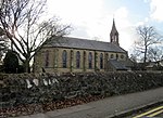
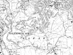
Quinton, is a residential area and ward of Birmingham, England just under 5 miles (8 km) west of the city centre. Formerly part of Halesowen parish, Quinton became part of Birmingham in 1909. Quinton was a village and the surrounding area was farmland until the 1930s when the first housing estates were developed. Most of the farmland had been built on by 1980 but some countryside remains in the form of Woodgate Valley Country Park. Along with Bartley Green, Harborne and Edgbaston, Quinton is a part of the Birmingham Edgbaston constituency.
Excerpt from the Wikipedia article Quinton, Birmingham (License: CC BY-SA 3.0, Authors, Images).Quinton, Birmingham
Grayswood Park Road, Birmingham
Geographical coordinates (GPS) Address Nearby Places Show on map
Geographical coordinates (GPS)
| Latitude | Longitude |
|---|---|
| N 52.46 ° | E -2 ° |
Address
Grayswood Park Road
Grayswood Park Road
B32 1HE Birmingham
England, United Kingdom
Open on Google Maps


