place

Hengrove

Areas of BristolBristol geography stubsEngvarB from October 2013Places formerly in SomersetWards of Bristol
Bristol hengrove
Bristol hengrove

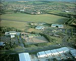
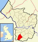
Hengrove is a suburb and council ward of Bristol, England, situated between Whitchurch, Knowle and Bishopsworth, running along both dual carriageways, Wells Road (A37) and Airport Road (A4174). The area of Knowle it adjoins is known as Knowle West. The residential parts of Hengrove consist mainly of working to middle class terrace houses. There are also infant, primary and secondary schools in the area. It is served by buses and, since 2019, MetroBus rapid transit services. Hengrove holds the long-disused Whitchurch Airport, which has mostly been redeveloped with a hospital and leisure facilities now situated on parts of the former airfield.

Excerpt from the Wikipedia article Hengrove (License: CC BY-SA 3.0, Authors, Images).

Hengrove
Hengrove Way, Bristol Hartcliffe

Geographical coordinates (GPS) Address Nearby Places
placeShow on map

Wikipedia: HengroveContinue reading on Wikipedia

Geographical coordinates (GPS)

Latitude Longitude
N 51.416 ° E -2.5918 °
placeShow on map

Address

Hengrove Way

Hengrove Way
BS4 1XJ Bristol, Hartcliffe
England, United Kingdom
mapOpen on Google Maps

Bristol hengrove
Bristol hengrove
Share experience

Nearby Places

Whitchurch Circuit
Whitchurch Circuit

Whitchurch Circuit was a motor racing circuit located at the former Bristol (Whitchurch) Airport in Bristol, England. The Bristol & Wessex Aeroplane Club first flew from this airfield in 1930. During World War II it was used by the Air Transport Auxiliary and British Overseas Airways Corporation. It continued as Bristol's commercial airport until in 1957 this moved to Bristol Lulsgate Airport, where the Lulsgate Circuit had been. On 1 August 1959, the Bristol Motorcycle and Light Car Club (BM&LCC) organised the first race meeting in conjunction with the Bristol Corporation, who owned the then disused airfield at Whitchurch. The course was 1.0625 miles (1.71 km) long, almost flat, and rectangular in shape with four corners known as Dundry, Hangar, Knowle, and Goram. The meeting consisted of six races, one of which was for Formula Two cars. This race was won by Henry Taylor, at a speed of 66.03 mph (106.26 km/h), from Keith Greene and Tim Parnell, all of whom were Cooper mounted. The fastest lap was set by Taylor at 66.64 mph (107.25 km/h). However, the fastest lap of the day was set by a Formula III car in exactly 53 seconds (72.17 mph (116.15 km/h)) by Jack Pitcher in a race won by Philip Robinson (Stuart-Cooper). It is probable that this is the outright all-time lap record at this track at Whitchurch as this may have been the only car meeting held here, though it is possible that another was held later in this year. The report of the meeting in Autosport speaks of indifferent weather with only the first and last races being run on a dry track, which probably accounts for the Formula III cars being faster than the Formula 2.The following weekend, 8 August 1959, the Bristol Motor Cycle Club held a motor-cycle race meeting, with Phil Read winning both the 350cc and 500cc abroad Nortons, taking fastest lap in both at 69.25 mph (111.45 km/h) and 72.07 mph (115.99 km/h) respectively. Note that this fastest lap was only 0.1 mph (0.16 km/h) slower than Jack Pitcher's outright lap, also using a Norton engine in his Cooper.In 1937, on 22 May, the BM&LCC ran a one-off Speed Trail on the approach road to Whitchurch. The 17-foot-wide (5.2 m) course was 750 yd (690 m) long with a slight right followed by a long left-hand bend.

Knowle West
Knowle West

Knowle West is a neighbourhood situated on a low plateau in the south of Bristol, England, about 2 miles (3 km) from the centre of the city. Historically in Somerset, most of the area is coterminous with the Filwood ward of Bristol City Council, although a small part of the estate lies within Knowle ward to the east. To the west are Bishopsworth and Hartcliffe. To the north are Bedminster and Windmill Hill and to the south Whitchurch Park and Hengrove. In 2008 the population was estimated to be 11,787. The area is approximately 1.26 square miles (3.3 km2). There is evidence of late Iron Age and Roman settlements in the area. At the time of the Domesday Book, Knowle was a rural area assessed at a taxable value of two geld units. Knowle West remained rural in character until the 1930s, when a council housing estate was developed to provide homes for people displaced by slum clearance in the centre of the city. Famous former residents include the musician Tricky, the England rugby player Ellis Genge, the boxer Dixie Brown and late 1950s rock and roll band the Eagles. There are two schools and two churches in Knowle West, as well as a number of open spaces, community centre,no clubs and no shopping facilities at Filwood Broadway except a news agent, a cafe and a chemist. Community organisations include the Knowle West Media Centre, the Residents' Planning Group and the Knowle West Health Association. There are no major employers in Knowle West and very little local enterprises it has no infrastructure but have larger businesses on nearby trading estates. The closure of the Imperial Tobacco factory at nearby Hartcliffe in 1990 caused a large number of job losses. Just under a third of the residents are classed as economically inactive and the area is the most economically deprived in Bristol.