Knowle West

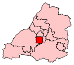
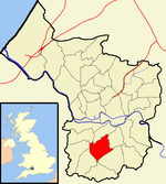
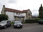
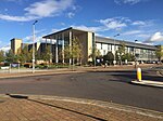
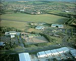
Knowle West is a neighbourhood situated on a low plateau in the south of Bristol, England, about 2 miles (3 km) from the centre of the city. Historically in Somerset, most of the area is coterminous with the Filwood ward of Bristol City Council, although a small part of the estate lies within Knowle ward to the east. To the west are Bishopsworth and Hartcliffe. To the north are Bedminster and Windmill Hill and to the south Whitchurch Park and Hengrove. In 2008 the population was estimated to be 11,787. The area is approximately 1.26 square miles (3.3 km2). There is evidence of late Iron Age and Roman settlements in the area. At the time of the Domesday Book, Knowle was a rural area assessed at a taxable value of two geld units. Knowle West remained rural in character until the 1930s, when a council housing estate was developed to provide homes for people displaced by slum clearance in the centre of the city. Famous former residents include the musician Tricky, the England rugby player Ellis Genge, the boxer Dixie Brown and late 1950s rock and roll band the Eagles. There are two schools and two churches in Knowle West, as well as a number of open spaces, community centre,no clubs and no shopping facilities at Filwood Broadway except a news agent, a cafe and a chemist. Community organisations include the Knowle West Media Centre, the Residents' Planning Group and the Knowle West Health Association. There are no major employers in Knowle West and very little local enterprises it has no infrastructure but have larger businesses on nearby trading estates. The closure of the Imperial Tobacco factory at nearby Hartcliffe in 1990 caused a large number of job losses. Just under a third of the residents are classed as economically inactive and the area is the most economically deprived in Bristol.
Excerpt from the Wikipedia article Knowle West (License: CC BY-SA 3.0, Authors, Images).Knowle West
Wicklow Road, Bristol Knowle
Geographical coordinates (GPS) Address Nearby Places Show on map
Geographical coordinates (GPS)
| Latitude | Longitude |
|---|---|
| N 51.426 ° | E -2.59 ° |
Address
Wicklow Road
Wicklow Road
BS4 1JY Bristol, Knowle
England, United Kingdom
Open on Google Maps
