Carlsruhe, Victoria
Shire of Macedon RangesTowns in Victoria (state)Use Australian English from August 2019

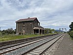
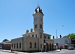
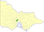
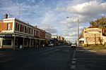
Carlsruhe () is a town in the Shire of Macedon Ranges between Woodend and Kyneton, alongside the old Calder Highway, although now bypassed by the Calder Freeway. It is approximately 50 minutes from both Melbourne and Bendigo. At the 2011 census, Carlsruhe and the surrounding area had a population of 456.
Excerpt from the Wikipedia article Carlsruhe, Victoria (License: CC BY-SA 3.0, Authors, Images).Carlsruhe, Victoria
Nicholson Street, Shire of Macedon Ranges
Geographical coordinates (GPS) Address Nearby Places Show on map
Geographical coordinates (GPS)
| Latitude | Longitude |
|---|---|
| N -37.283333333333 ° | E 144.5 ° |
Address
Nicholson Street
Nicholson Street
Shire of Macedon Ranges (Carlsruhe)
Victoria, Australia
Open on Google Maps


