place

Bear Swamp

1968 establishments in MassachusettsForests of MassachusettsOpen space reserves of MassachusettsProtected areas established in 1968Protected areas of Franklin County, Massachusetts
The Trustees of Reservations
AshfieldMA BearSwamp AppleValleyView

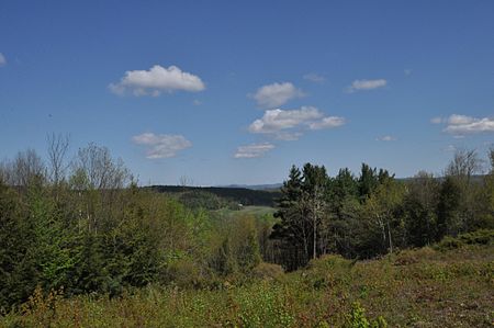
Bear Swamp is a forested parkland in Ashfield, Massachusetts. The Trustees of Reservations owns and maintains the property. Although Bear Swamp was once a sheep pasture and later a source of cordwood and lumber, it now seems much like an untouched wilderness. The landscape is irregular, well-drained, and covered with nutrient-rich soils. Protected from the elements, hardwood trees such as ash, hickory, basswood, maple, and cherry grow straight and tall. Three miles (5 km) of trails lead to different parts of the reservation. The Beaver Brook Trail traces the southern rim of a shallow pond and wet meadow where an old beaver dam rests atop an old stone milldam. Although many trees have died in the flooded zone, the water is receding and the forest is returning. The Fern Glade Trail features a variety of ferns and woodland wildflowers. A scenic vista on the Lookout Trail and the hillside meadow at the Apple Valley Overlook both offer views of nearby apple orchards and the Green Mountains of Vermont beyond. Seasonal hunting is permitted at this property subject to all state and town laws.

Excerpt from the Wikipedia article Bear Swamp (License: CC BY-SA 3.0, Authors, Images).

Geographical coordinates (GPS)

Latitude Longitude
N 42.548611111111 ° E -72.825833333333 °
placeShow on map

Address

Bear Swamp

Apple Valley Road
01338
Massachusetts, United States
mapOpen on Google Maps

Website
thetrustees.org

linkVisit website

linkWikiData (Q4876574)
linkOpenStreetMap (29849345)

AshfieldMA BearSwamp AppleValleyView
Share experience

Nearby Places

East Hawley Center Historic District

The East Hawley Center Historic District encompasses the principal institutional center of the town of Hawley, Massachusetts, with a history dating to the 1780s. Although it was settled in the late 18th century, issues with Hawley's boundaries meant that the development of a central village did not take place until later. East Hawley was developing as a local transportation hub by the mid-1820s, with several roads (mainly East Hawley Road, Plainfield Road, Ashfield Road, and Buckland Road, the latter three leading to eponymous neighboring towns) converging in the area. The establishment of a store and post office, and the relocation of the Congregational Church into the area cemented its importance in the town's civic life. There was some industrial mill activity in the area during the 19th century, but this came to an end near the end of the century, and only a mill pond remains. The district was listed on the National Register of Historic Places in 1992.The historic district occupies a small plateau in the eastern part of the hilly town, extending along Plainfield Road between Buckland Road and Ashfield Road. The northern junction is the focal point of the village, where the town's small common (laid out in 1848) and church are located. The architecture in the district is largely vernacular in character, with modest stylistic elements from late 18th to late 19th century architectural styles. The church is probably the most architecturally sophisticated building; it is Greek Revival in character and dates to the late 1840s. One unusual feature of the district is a rare 19th-century charcoal-making kiln, which is set in the woods at the western edge of the district; it is one of the reminder's of the village's modest industrial history.

The Wilder Homestead

The Wilder Homestead is located on Ashfield Road (Massachusetts Route 112), 0.25 miles (0.40 km) south of the Upper Road/Ashfield Road junction, in Buckland, Massachusetts. The property includes three buildings, two of which contribute to its significance. The house was built c. 1775, and is a fairly typical Georgian colonial two story house, in which the rear roof extends down to the first floor in saltbox fashion. A 19th century ell extends from the east side of the house. The house was built for Gardner Wilder, who had recently moved to the area, and had purchased 200 acres (81 ha) to farm.The second contributing structure is a barn, whose construction was also begun by Gardner Wilder c. 1775. It was significantly enlarged with a full-height full-width extension in 1840, and a second extension, a 1+1⁄2-story equipment shed, was added in the 20th century. The oldest portion shows typical English colonial post and beam construction techniques, and its beams were axe-hewn, unlike those of the first addition, which show saw marks. The equipment shed was built using modern balloon framing methods.The property remained in the hands of Gardner Wilder's descendants until 1981, when the homestead and a 58-acre (23 ha) parcel of land were donated to the Buckland Historical Society. The Society moved a 19th-century shoe shop to the property in 1991, and operates the site as a historic house museum. The property was listed on the National Register of Historic Places in 2011.