place

Berkshire East Ski Resort

Buildings and structures in Franklin County, MassachusettsSki areas and resorts in MassachusettsSports in Franklin County, MassachusettsTourist attractions in Franklin County, Massachusetts
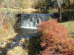
Berkshire East Ski Resort from Charlemont, September 2022

Berkshire East Ski Resort is a medium-sized alpine ski area in the northeastern United States, located in the Berkshires on Mount Institute in Charlemont and Hawley, Massachusetts.

Excerpt from the Wikipedia article Berkshire East Ski Resort (License: CC BY-SA 3.0, Authors, Images).

Berkshire East Ski Resort
Sugar Run,

Geographical coordinates (GPS) Address Nearby Places
placeShow on map

Wikipedia: Berkshire East Ski ResortContinue reading on Wikipedia

Geographical coordinates (GPS)

Latitude Longitude
N 42.620833333333 ° E -72.876944444444 °
placeShow on map

Address

Berkshire East Ski Area

Sugar Run
01339
Massachusetts, United States
mapOpen on Google Maps

Berkshire East Ski Resort from Charlemont, September 2022
Share experience

Nearby Places

Bissell Bridge (Massachusetts)

The Bissell Bridge is a historic covered bridge on Heath Road (Massachusetts Route 8A) over Mill Brook in Charlemont, Massachusetts. The TECO Enhanced Long through truss bridge was built in 1951 by the T. J. Harvey Company, to a design by the Timber Engineering Company (TECO) and the Massachusetts Department of Transportation (DOT). The bridge is 92 feet (28 m) long, and rests on stone-faced reinforced concrete abutments. Mill Brook passes fifteen to twenty feet below the bridge at normal water levels. It was the first covered bridge to be built in Massachusetts in the 20th century, replacing an earlier covered bridge that dated to about 1881.The bridge is sited near an old mill dam and pond, and is not far (about 200 feet (61 m)) from the house of Henry W. Bissell, for whom it is named. The town appropriated $1000 for its construction in 1880, and it is assumed to have been built not long afterward. By the mid 20th century the bridge was deteriorating, and the DOT condemned it. The town vehemently opposed the construction of a modern steel-and-concrete structure as its replacement, and the matter drew a great deal of media attention. The design that resulted from the decision-making process was a near replica of the original bridge. It was built at a cost (shared by all levels of government) of $50,000 to $55,000. The only major deviations from the original design were made to accommodate modern roadway requirements. By the end of the 20th century, the new bridge was also deteriorating, and was closed and rehabilitated. The bridge was added to the National Register of Historic Places in 2004.

East Hawley Center Historic District

The East Hawley Center Historic District encompasses the principal institutional center of the town of Hawley, Massachusetts, with a history dating to the 1780s. Although it was settled in the late 18th century, issues with Hawley's boundaries meant that the development of a central village did not take place until later. East Hawley was developing as a local transportation hub by the mid-1820s, with several roads (mainly East Hawley Road, Plainfield Road, Ashfield Road, and Buckland Road, the latter three leading to eponymous neighboring towns) converging in the area. The establishment of a store and post office, and the relocation of the Congregational Church into the area cemented its importance in the town's civic life. There was some industrial mill activity in the area during the 19th century, but this came to an end near the end of the century, and only a mill pond remains. The district was listed on the National Register of Historic Places in 1992.The historic district occupies a small plateau in the eastern part of the hilly town, extending along Plainfield Road between Buckland Road and Ashfield Road. The northern junction is the focal point of the village, where the town's small common (laid out in 1848) and church are located. The architecture in the district is largely vernacular in character, with modest stylistic elements from late 18th to late 19th century architectural styles. The church is probably the most architecturally sophisticated building; it is Greek Revival in character and dates to the late 1840s. One unusual feature of the district is a rare 19th-century charcoal-making kiln, which is set in the woods at the western edge of the district; it is one of the reminder's of the village's modest industrial history.