A814 road
ClydebankDumbartonHelensburghInfobox road instances in ScotlandInfobox road maps tracking category ... and 6 more
PartickRoads in ScotlandTransport in Argyll and ButeTransport in GlasgowTransport in West DunbartonshireUse British English from September 2023

The A814 road in Scotland (known for part of its length as the Clydeside Expressway) is a major arterial route within Glasgow, connecting the city centre to the west end. Running along the right (north) bank of the River Clyde, it continues further west through Clydebank and Dumbarton, leaving the suburban environment and serving as the main road for Helensburgh, turning north to meet the A83 at Arrochar, Argyll and Bute.
Excerpt from the Wikipedia article A814 road (License: CC BY-SA 3.0, Authors, Images).A814 road
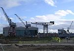
Clydeside Expressway, Glasgow Partick
Geographical coordinates (GPS) Address Nearby Places Show on map
Geographical coordinates (GPS)
| Latitude | Longitude |
|---|---|
| N 55.8697 ° | E -4.3186 ° |
Address
Clydeside Expressway
Clydeside Expressway
G11 6DN Glasgow, Partick
Scotland, United Kingdom
Open on Google Maps


