Newthorpe, North Yorkshire
Former civil parishes in North YorkshireNorth Yorkshire geography stubsSelby DistrictUse British English from February 2019Villages in North Yorkshire

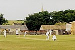
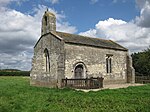
Newthorpe is a settlement lying alongside the B1222 road, in the civil parish of Huddleston with Newthorpe, to the west of Sherburn in Elmet village and stretching across to the A1(M) Motorway in the English county of North Yorkshire.The village was historically part of the West Riding of Yorkshire until 1974. Newthorpe was formerly a township in the parish of Sherburn, in 1866 Newthorpe became a separate civil parish, on 1 April 1937 the parish was abolished and merged with Huddleston cum Lumby to form "Huddleston with Newthorpe". In 1931 the parish had a population of 111. From 1974 to 2023 it was in the Selby district.
Excerpt from the Wikipedia article Newthorpe, North Yorkshire (License: CC BY-SA 3.0, Authors, Images).Newthorpe, North Yorkshire
Hall Lane,
Geographical coordinates (GPS) Address Nearby Places Show on map
Geographical coordinates (GPS)
| Latitude | Longitude |
|---|---|
| N 53.78403 ° | E -1.2912 ° |
Address
Hall Lane
Hall Lane
LS25 6JN , Huddleston with Newthorpe
England, United Kingdom
Open on Google Maps


