place

Ledsham, West Yorkshire

City of LeedsCivil parishes in West YorkshireUse British English from July 2020Villages in West YorkshireWest Yorkshire geography stubs
Ledsham Village Cricket

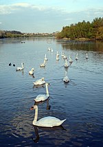
Ledsham is a village and civil parish 4 miles (6 km) north of Castleford and 11 miles (18 km) east of Leeds in the county of West Yorkshire, England. The village is in the City of Leeds metropolitan borough and near to the A1(M) motorway. It had a population of 162 at the 2001 Census, increasing to 181 at the 2011 Census.

Excerpt from the Wikipedia article Ledsham, West Yorkshire (License: CC BY-SA 3.0, Authors, Images).

Ledsham, West Yorkshire
Claypit Lane, Leeds Ledsham

Geographical coordinates (GPS) Address Nearby Places
placeShow on map

Wikipedia: Ledsham, West YorkshireContinue reading on Wikipedia

Geographical coordinates (GPS)

Latitude Longitude
N 53.762 ° E -1.31 °
placeShow on map

Address

Claypit Lane
LS25 5LP Leeds, Ledsham
England, United Kingdom
mapOpen on Google Maps

Ledsham Village Cricket
Share experience

Nearby Places

Ferry Fryston
Ferry Fryston

Ferry Fryston is a suburb of the town of Castleford in West Yorkshire, England. It is situated in the metropolitan borough of the City of Wakefield. The appropriate ward is called Airedale and Ferry Fryston. Ferry Fryston was an ancient parish in the wapentake of Osgoldcross in the West Riding of Yorkshire. Until the 19th century the parish surrounded 48 small detached parts (mostly field strips) of the parish of Pontefract. The parish also included the hamlets of Water Frystone, Wheldale, and Ferrybridge. The parish became a civil parish in 1866. The civil parish was abolished in 1938. Most of the civil parish was absorbed into the civil parishes of Castleford and Knottingley, with smaller areas going to the civil parishes of Pontefract and Fairburn. Coal mines existed within the boundaries of the former parish in New Fryston, locally known as Fryston Pit, and in Wheldale. The former closed in 1985. The area where the mine once stood has now been re-developed. Wakefield Metropolitan District Council approved plans in November 2007 for 150 new dwellings, parkland and public open space. The dwellings have still yet to be built. Wheldale colliery closed in 1987. Its buildings above ground have been demolished. The areas of both collieries have been subject to land remediation work.Most homes in the area were homes of local miners. Local authority housing was transferred in 2005 to a charitable community benefit organisation, Wakefield District Housing.