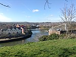
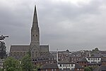
St Thomas, Exeter

St Thomas (St Thomas the Apostle's) is an area of Exeter and formerly a 3,700-acre (15 km2) civil parish and registration district in Devon, England, on the western side of the River Exe, connected to Exeter by Exe Bridge. It has a number of pubs, places of worship, several schools and a large shopping precinct. The population, according to the 2001 census, is 6,246, increasing to 6,455 at the 2011 Census.St Thomas ward is currently politically represented by County and City Councillor, Rob Hannaford and City Councillor Adrian Fullam. It originally consisted of two detached parts, the main part of which was the former village of Cowick, to the west of the River Exe. The urban area built up here but was not originally part of Exeter. The other part, about a mile to the west of the main body of the parish, contained the hamlet of Oldridge and was transferred to the parish of Whitestone in 1884. St Thomas the Apostle became an urban district in 1894 with the passing of the Local Government Act 1894, and was incorporated into the municipal borough of Exeter in 1900. The name survives for the central area of Exeter west of the river. A St Thomas Rural District existed from 1894 to 1974. St Thomas is served by Exeter St Thomas railway station.
Excerpt from the Wikipedia article St Thomas, Exeter (License: CC BY-SA 3.0, Authors, Images).St Thomas, Exeter
Cecil Road, Exeter St Thomas
Geographical coordinates (GPS) Address Nearby Places Show on map
Geographical coordinates (GPS)
| Latitude | Longitude |
|---|---|
| N 50.716 ° | E -3.54 ° |
Address
Cecil Road 27
EX2 9AQ Exeter, St Thomas
England, United Kingdom
Open on Google Maps


