Old Exe Bridge

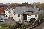
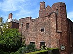
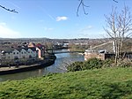
The Old Exe Bridge is a ruined medieval arch bridge in Exeter in south-western England. Construction of the bridge began in 1190, and was completed by 1214. The bridge is the oldest surviving bridge of its size in England and the oldest bridge in Britain with a chapel still on it. It replaced several rudimentary crossings which had been in use sporadically since Roman times. The project was the idea of Nicholas and Walter Gervase, father and son and influential local merchants, who travelled the country to raise funds. No known records survive of the bridge's builders. The result was a bridge at least 590 feet (180 metres) long, which probably had 17 or 18 arches, carrying the road diagonally from the west gate of the city wall across the River Exe and its wide, marshy flood plain. St Edmund's Church, the bridge chapel, was built into the bridge at the time of its construction, and St Thomas's Church was built on the riverbank at about the same time. The Exe Bridge is unusual among British medieval bridges for having had secular buildings on it as well as the chapel. Timber-framed shops, with houses above, were in place from at least the early 14th century, and later in the bridge's life, all but the most central section carried buildings. As the river silted up, land was reclaimed, allowing a wall to be built from the side of St Edmund's which protected a row of houses and shops which became known as Frog Street. Walter Gervase also commissioned a chantry chapel, built opposite the church, which came into use after 1257 and continued until the Reformation in the mid-16th century. The medieval bridge collapsed and had to be partially rebuilt several times throughout its life; the first recorded rebuilding was in 1286. By 1447 the bridge was severely dilapidated, and the mayor of Exeter appealed for funds to repair it. By the 16th century, it was again in need of repairs. Nonetheless, the bridge was in use for almost 600 years, until a replacement was built in 1778 and the arches across the river were demolished. That bridge was itself replaced in 1905, and again in 1969 by a pair of bridges. During construction of the twin bridges, eight and a half arches of the medieval bridge were uncovered and restored, some of which had been buried for nearly 200 years, and the surrounds were landscaped into a public park. Several more arches are buried under modern buildings. The bridge's remains are a scheduled monument and grade II listed building.
Excerpt from the Wikipedia article Old Exe Bridge (License: CC BY-SA 3.0, Authors, Images).Old Exe Bridge
Western Way, Exeter St Thomas
Geographical coordinates (GPS) Address External links Nearby Places Show on map
Geographical coordinates (GPS)
| Latitude | Longitude |
|---|---|
| N 50.719 ° | E -3.5361 ° |
Address
Old Exe Bridge
Western Way
EX2 4BB Exeter, St Thomas
England, United Kingdom
Open on Google Maps


