Norbury, Greater Manchester
Areas of Greater ManchesterGeography of the Metropolitan Borough of StockportGreater Manchester geography stubs

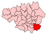
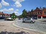
Norbury is in Greater Manchester, England. A civil parish in Cheshire from 1866 to 1900, it now forms part of Hazel Grove in the Metropolitan Borough of Stockport. Norbury was one of the eight civil parishes of Cheshire to be included in the Stockport rural sanitary district in 1875. From 1894 it formed part of the Stockport Rural District. In 1900 the parish was abolished and it became part of the Hazel Grove and Bramhall civil parish and urban district. Hazel Grove and Bramhall was abolished in 1974 and Norbury has since formed part of the Metropolitan Borough of Stockport in Greater Manchester.
Excerpt from the Wikipedia article Norbury, Greater Manchester (License: CC BY-SA 3.0, Authors, Images).Norbury, Greater Manchester
Rutland Road,
Geographical coordinates (GPS) Address Nearby Places Show on map
Geographical coordinates (GPS)
| Latitude | Longitude |
|---|---|
| N 53.37 ° | E -2.12 ° |
Address
Rutland Road
Rutland Road
SK7 6JE , Bramhall Moor
England, United Kingdom
Open on Google Maps


