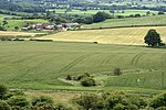
Roseberry Topping

Roseberry Topping is a distinctive hill in North Yorkshire, England. It is situated near Great Ayton and Newton under Roseberry. Its summit has a distinctive half-cone shape with a jagged cliff, which has led to many comparisons with the much higher Matterhorn in the Swiss-Italian Alps. It forms a symbolic image of the area and features in the logo for the nearby Teesside International Airport.At 1,049 feet (320 m), Roseberry Topping was traditionally thought to be the highest hill on the North York Moors; however, there are 15 higher peaks with the nearby Urra Moor being the highest, at 1,490 feet (450 m). Roseberry Topping offers views of Captain Cook's Monument at Easby Moor and the monument at Eston Nab, previously a beacon.
Excerpt from the Wikipedia article Roseberry Topping (License: CC BY-SA 3.0, Authors, Images).Roseberry Topping
Brant Gate,
Geographical coordinates (GPS) Address Nearby Places Show on map
Geographical coordinates (GPS)
| Latitude | Longitude |
|---|---|
| N 54.50542 ° | E -1.10736 ° |
Address
Brant Gate
TS9 6QX
England, United Kingdom
Open on Google Maps


