place

Malvern Wells

Civil parishes in WorcestershireHoly wells in EnglandMalvern, WorcestershireVillages in Worcestershire
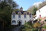
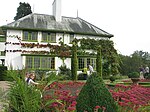
Malvern Wells village, Worcestershire, England. August 2011

Malvern Wells is a village and civil parish south of Great Malvern in the Malvern Hills district of Worcestershire, England. The parish, once known as South Malvern, was formed in 1894 from parts of the civil parishes of Hanley Castle, Welland, and the former parish of Great Malvern, and owes its development to the 19th-century boom years of Malvern as a spa town. Malvern Wells is a centre of commercial bottling of Malvern water. The population of the parishes of Malvern Wells and Little Malvern was recorded in 2011 as 3,196.

Excerpt from the Wikipedia article Malvern Wells (License: CC BY-SA 3.0, Authors, Images).

Malvern Wells
Wells Road, Malvern Hills

Geographical coordinates (GPS) Address Nearby Places
placeShow on map

Wikipedia: Malvern WellsContinue reading on Wikipedia

Geographical coordinates (GPS)

Latitude Longitude
N 52.078479 ° E -2.332357 °
placeShow on map

Address

Wells Road

Wells Road
WR14 4HF Malvern Hills
England, United Kingdom
mapOpen on Google Maps

Malvern Wells village, Worcestershire, England. August 2011
Share experience

Nearby Places

Wyche, Worcestershire

Wyche ( WITCH), often referred to locally as The Wyche, is a village and a suburb of the town of Malvern, Worcestershire, England, and part of the civil parish of Malvern Wells. It is situated approximately 1 mile (1.6 km) south of Great Malvern, the town's centre, on the B4218 road that runs from Malvern to Colwall. The western boundary of the village is marked by The Wyche Cutting, a pass through the Malvern Hills that was once part of an Iron Age salt route, hence the name "Wyche" — several places in England associated with salt have this (or similar) in their name. As the crest of the Malvern Hills (running north to south) defines this part of the border between the two counties of Herefordshire and Worcestershire, The Wyche Cutting itself forms a narrow pass through the hills between the counties. From the 1920s until the 1960s, this road (passing through The Wyche Cutting and Colwall) was the A4105, before being re-classified as the B4218. The Wyche village comprises the two informal areas of Upper Wyche and Lower Wyche, mainly comprising residential properties. The Wyche Inn is a public house situated in Upper Wyche and is the county's highest pub, with views to the east overlooking the Severn valley. Old Wyche Road is one of the country's steepest streets, with an incline as great as 17.54° at Upper Wyche.Just on the Herefordshire side of the Cutting (in Upper Colwall) is the location of the Wyche Innovation Centre, that was the former Skot Transformers building. This is also the home of the Malvern Hills Geocentre, a visitor centre based entirely on iPads with an attached cafe. Also in Upper Colwall is the Wyche Free Church.The nearest railway stations are Great Malvern (for the lower end) and Colwall (for the upper end); both are on the same line. The Wyche CE Primary School is located in Lower Wyche.