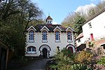
Upper Welland
Malvern, WorcestershireUse British English from September 2019Villages in WorcestershireWorcestershire geography stubs

Upper Welland is a small settled area within the civil parish of Malvern Wells, in Worcestershire, England. Lying close to the county boundaries of Herefordshire.It was formed when the upper part of Welland parish joined the newly created Malvern Hills Urban District. Welland Parish once stretched to the ridge of the Malvern Hills. Its average elevation is 115 metres above the sea level.
Excerpt from the Wikipedia article Upper Welland (License: CC BY-SA 3.0, Authors, Images).Upper Welland
Upper Welland Road, Malvern Hills
Geographical coordinates (GPS) Address Nearby Places Show on map
Geographical coordinates (GPS)
| Latitude | Longitude |
|---|---|
| N 52.065882 ° | E -2.325304 ° |
Address
Upper Welland Road
WR14 4LJ Malvern Hills
England, United Kingdom
Open on Google Maps


