place

Archcliffe Fort

Forts in Dover, KentScheduled monuments in KentUse British English from October 2024
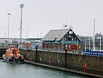
Archcliffe Fort, Dover (geograph 4607184)

Archcliffe Fort is a former military installation in Dover, England. It is situated at the base of the Dover Western Heights and overlooks the approaches to the port of Dover. A watchtower was erected on the site in 1370 but this was replaced with a more substantial fort by Henry VIII by 1539. The fort fell into disrepair but was renovated in 1588 due to concerns over the Spanish Armada. The Stuart kings James VI and I and Charles I made improvements to the fort and it was heavily garrisoned by Charles II in the aftermath of the 1660 Stuart Restoration. Invasion scares during the long eighteenth century saw further improvements to the defences. The fort was manned during the First World War but in the 1920s much of it was demolished to allow for improvements to be made to the South Eastern Main Line railway. The fort was deemed obsolete by the time of the Second World War and was decommissioned in 1956, after which further demolition took place to widen the A20 road. The surviving structure includes two ramparts and two complete corner bastions, together with some modern buildings in the interior. The fort is used by the Emmaus Community to house formerly homeless people and operates a furniture workshop and retail centre.

Excerpt from the Wikipedia article Archcliffe Fort (License: CC BY-SA 3.0, Authors, Images).

Archcliffe Fort
Hawkesbury Street,

Geographical coordinates (GPS) Address Nearby Places
placeShow on map

Wikipedia: Archcliffe FortContinue reading on Wikipedia

Geographical coordinates (GPS)

Latitude Longitude
N 51.115 ° E 1.3072222222222 °
placeShow on map

Address

Hawkesbury Street

Hawkesbury Street
CT17 9EG , Clarendon
England, United Kingdom
mapOpen on Google Maps

Archcliffe Fort, Dover (geograph 4607184)
Share experience

Nearby Places

River Dour
River Dour

The River Dour is a chalk stream in the county of Kent, England. It flows from the villages of Temple Ewell and River between which is a neighbourhood served by a railway station, Kearsney. It is roughly 4 miles (6.4 km) long. It originally had a wide estuary on the site of modern Dover, although today it flows into the Dover Harbour through a culvert. The estuary was a natural harbour for the Bronze Age settlers and traders in the area. The remains of a Bronze Age seagoing boat (from 3,500 years ago), known as the Dover Bronze Age Boat, were found in 1992, and it can be seen in Dover Museum. The Dour Estuary was then used as a port for the Roman town, as a natural harbour for the Roman fleet. This silted up in the medieval period, necessitating the construction of various artificial harbours for Dover instead.The river has been used since AD 762 to power various watermills along its route. These included eight corn mills and five paper mills. Buckland Mill near Buckland Bridge was one of the earliest corn mills, but has since been converted into flats. Crabble Mill is now a fully restored corn mill and museum, and the Old Mill in Kearsney is now a private house, the others have been converted for various uses. Other industries on the river included iron foundries, saw mills (demolished) and a tannery (also converted).Kearsney, Kent and Kearsney Abbey (a former Grand House) is also beside the River. The River Dour Trail is a new walking trail (set up by the White Cliffs Countryside Project). It follows the Dour from Temple Ewell to Wellington Dock on the seafront. The trail is about 4 miles (6 km) long and takes 2.5 hours to walk fully.