place

HMS Glatton (1914)

1914 ships1918 disasters in the United KingdomBjørgvin-class coastal defence shipsGorgon-class monitorsMaritime disasters in Kent
Maritime incidents in 1918Ships built by Armstrong WhitworthShips built in Barrow-in-FurnessShips sunk by non-combat internal explosionsUse British English from February 2017
HMS Glatton
HMS Glatton

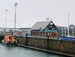
HMS Glatton and her sister ship Gorgon were originally built as coastal defence ships for the Royal Norwegian Navy, as Bjørgvin and Nidaros respectively. She was requisitioned from Norway at the beginning of World War I, but was not completed until 1918 although she had been launched over three years earlier. On 16 September 1918, before she had even gone into action, she suffered a large fire in one of her 6-inch magazines, and had to be scuttled to prevent an explosion of her main magazines that would have devastated Dover. Her wreck was partially salvaged in 1926, and moved into a position in the northeastern end of the harbour where it would not obstruct traffic. It was subsequently buried by landfill underneath the current car ferry terminal.

Excerpt from the Wikipedia article HMS Glatton (1914) (License: CC BY-SA 3.0, Authors, Images).

HMS Glatton (1914)
New Marina Curve Road,

Geographical coordinates (GPS) Address Nearby Places
placeShow on map

Wikipedia: HMS Glatton (1914)Continue reading on Wikipedia

Geographical coordinates (GPS)

Latitude Longitude
N 51.117 ° E 1.315 °
placeShow on map

Address

New Marina Curve Road
CT17 9FJ , Clarendon
England, United Kingdom
mapOpen on Google Maps

HMS Glatton
HMS Glatton
Share experience

Nearby Places

River Dour
River Dour

The River Dour is a chalk stream in the county of Kent, England. It flows from the villages of Temple Ewell and River between which is a neighbourhood served by a railway station, Kearsney. It is roughly 4 miles (6.4 km) long. It originally had a wide estuary on the site of modern Dover, although today it flows into the Dover Harbour through a culvert. The estuary was a natural harbour for the Bronze Age settlers and traders in the area. The remains of a Bronze Age seagoing boat (from 3,500 years ago), known as the Dover Bronze Age Boat, were found in 1992, and it can be seen in Dover Museum. The Dour Estuary was then used as a port for the Roman town, as a natural harbour for the Roman fleet. This silted up in the medieval period, necessitating the construction of various artificial harbours for Dover instead.The river has been used since AD 762 to power various watermills along its route. These included eight corn mills and five paper mills. Buckland Mill near Buckland Bridge was one of the earliest corn mills, but has since been converted into flats. Crabble Mill is now a fully restored corn mill and museum, and the Old Mill in Kearsney is now a private house, the others have been converted for various uses. Other industries on the river included iron foundries, saw mills (demolished) and a tannery (also converted).Kearsney, Kent and Kearsney Abbey (a former Grand House) is also beside the River. The River Dour Trail is a new walking trail (set up by the White Cliffs Countryside Project). It follows the Dour from Temple Ewell to Wellington Dock on the seafront. The trail is about 4 miles (6 km) long and takes 2.5 hours to walk fully.