Schliersberg
Bavaria geography stubsMiesbach (district)Mountains of BavariaMountains of the AlpsOne-thousanders of Germany

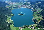
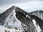
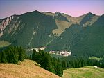
The Schliersberg (also known as Rhonberg or Rohnberg) is a 1,265-metre-high (4,150 ft) mountain in the Bavarian Prealps above the village Schliersee (Miesbach district, Upper Bavaria) and Lake Schliersee. The wooded summit can be reached within a 1.5 hour hike and passes the hut Schliersbergalm, located 1,055 m above sea level, which can also be reached by a cable car since 1952.
Excerpt from the Wikipedia article Schliersberg (License: CC BY-SA 3.0, Authors, Images).Schliersberg
Dekan-Maier-Weg,
Geographical coordinates (GPS) Address Nearby Places Show on map
Geographical coordinates (GPS)
| Latitude | Longitude |
|---|---|
| N 47.742777777778 ° | E 11.887777777778 ° |
Address
Dekan-Maier-Weg
83727
Bavaria, Germany
Open on Google Maps


