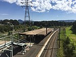
Cringila, New South Wales

Cringila () is a southern suburb of the city of Wollongong, New South Wales, Australia. The suburb is bounded by Berkeley, Unanderra, Lake Heights and Warrawong. The suburb is planned on a north-south residential/commercial strip and the east west streets that adjoin it, making a rectangular pattern. Cringila Community Park is a 78 ha site purchased by Wollongong City Council after residents defeated a proposal by BHP to use the land as a dump for industrial waste. Its main purpose is to regenerate the local area's natural wildlife. Surrounding Cringila's primary school is a protected rain forest. A fraction of Cringila is the Port Kembla steelworks, which is a major local employer. This led to an influx of ethnic groups, primarily Macedonian, Portuguese, Turks and Lebanese. This in turn transformed the demographics of Cringila significantly and at the 2001 census more people lived in households where Macedonian was spoken (31.8%) than in households where only English was spoken (24.6%), making it the only suburb in Australia where this was true. However, at the 2016 census only 18.5% of the population lived in households where Macedonian was spoken and 40.2% lived in households where only English was spoken.
Excerpt from the Wikipedia article Cringila, New South Wales (License: CC BY-SA 3.0, Authors, Images).Cringila, New South Wales
Lake Avenue, Wollongong City Council Cringila
Geographical coordinates (GPS) Address Nearby Places Show on map
Geographical coordinates (GPS)
| Latitude | Longitude |
|---|---|
| N -34.471111111111 ° | E 150.87194444444 ° |
Address
Lake Avenue
Lake Avenue
2502 Wollongong City Council, Cringila
New South Wales, Australia
Open on Google Maps


