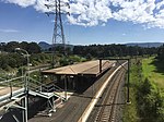
Port Kembla, New South Wales
Green bansPort cities in New South WalesSuburbs of WollongongUse Australian English from October 2014

Port Kembla is a suburb of Wollongong 10 km south of the CBD and part of the Illawarra region of New South Wales. The suburb comprises a seaport, industrial complex (one of the largest in Australia), a small harbour foreshore nature reserve, and a small commercial sector. It is situated on the tip of Red Point: its first European sighting was by Captain James Cook in 1770. The name "Kembla" is an Aboriginal word meaning "plenty [of] wild fowl".
Excerpt from the Wikipedia article Port Kembla, New South Wales (License: CC BY-SA 3.0, Authors, Images).Port Kembla, New South Wales
Old Port Road, Wollongong City Council Port Kembla
Geographical coordinates (GPS) Address Nearby Places Show on map
Geographical coordinates (GPS)
| Latitude | Longitude |
|---|---|
| N -34.475555555556 ° | E 150.90027777778 ° |
Address
BlueScope Steel Innovation
Old Port Road
2505 Wollongong City Council, Port Kembla
New South Wales, Australia
Open on Google Maps


