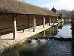
Loing
Bourgogne-Franche-Comté geography stubsCentre-Val de Loire geography stubsFrance river stubsPages with French IPARivers of Bourgogne-Franche-Comté ... and 8 more
Rivers of Centre-Val de LoireRivers of FranceRivers of LoiretRivers of Seine-et-MarneRivers of YonneRivers of Île-de-FranceSeine-et-Marne geography stubsTributaries of the Seine

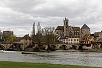
The Loing (French pronunciation: [lwɛ̃]) is a 143 km (89 mi) long river in central France, a left tributary of the Seine.Its source is in Sainte-Colombe-sur-Loing, in the southwestern of the department of Yonne, and it flows into the Seine in Saint-Mammès, near Moret-sur-Loing. Its main tributaries are the Ouanne, the Aveyron, the Puiseaux, the Solin, the Lunain and the Orvanne. The part of the Briare Canal between Rogny-les-Sept-Écluses and Montargis runs parallel to the Loing.
Excerpt from the Wikipedia article Loing (License: CC BY-SA 3.0, Authors, Images).Loing
Passerelle de Saint-Mammès, Fontainebleau
Geographical coordinates (GPS) Address Nearby Places Show on map
Geographical coordinates (GPS)
| Latitude | Longitude |
|---|---|
| N 48.386944444444 ° | E 2.8025 ° |
Address
Passerelle de Saint-Mammès
77670 Fontainebleau
Ile-de-France, France
Open on Google Maps
