place

First Encampment Park

1997 establishments in UtahMormon TrailParks in Salt Lake City
First Encampment Park, Stone Markers Salt Lake City, Utah 28 July 2018

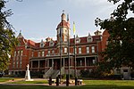
The First Encampment Park is a public pocket park in the Liberty Wells neighborhood of Salt Lake City, Utah. It is near the location where the initial group of Mormon pioneers spent their first night in what was then Mexico's Salt Lake Valley, on July 22, 1847. Meant to honor this first encampment in the valley, the park was dedicated on July 22, 1997, exactly 150 years after the event. Developed by local congregations of the Church of Jesus Christ of Latter-day Saints (LDS Church), the park was donated to the people of Salt Lake City.

Excerpt from the Wikipedia article First Encampment Park (License: CC BY-SA 3.0, Authors, Images).

First Encampment Park
1700 South, Salt Lake City

Geographical coordinates (GPS) Address Nearby Places
placeShow on map

Wikipedia: First Encampment ParkContinue reading on Wikipedia

Geographical coordinates (GPS)

Latitude Longitude
N 40.733336111111 ° E -111.87713888889 °
placeShow on map

Address

1700 South 464
84115 Salt Lake City
Utah, United States
mapOpen on Google Maps

First Encampment Park, Stone Markers Salt Lake City, Utah 28 July 2018
Share experience

Nearby Places

Forest Dale Historic District

The Forest Dale Historic District is located in the southeastern part of Salt Lake City, Utah and is roughly bounded by 700 East, Interstate 80, Commonwealth Avenue, and 900 East. It includes the "cohesive core" of the Forest Dale Subdivision platted in 1890, as well as the larger Town of Forest Dale, which was incorporated on January 6, 1902, disincorporated in the fall of 1912, and reabsorbed into the city of Salt Lake City. Both the subdivision and town were created by George Mousley Cannon (December 25, 1861–January 23, 1937), a member of the Cannon family, a prominent Intermountain West political family. The land for Forest Dale was originally Forest Farm, which Cannon had bought in 1889 from the estate of Brigham Young. Despite being bordered on 2 sides by major traffic corridors and on a third by a major arterial highway, the district "maintains its historic "inner-ring" suburban quality due to its tree-lined streets, uniform setbacks, and the similarity of scale in the housing stock." Forest Dale Golf Course is just southeast across I-80, and Fairmont Park is just to the east, separating Forest Dale from downtown Sugar House. The S Line (formerly known as Sugar House Streetcar) includes two stops near Forest Dale and Parley's Trail runs along the streetcar line. The streetcar and trail opened in late 2013 and early 2014, respectively. On April 23, 2009, it was added to the National Register of Historic Places (NRHP). One of the most significant buildings in the district is the George M. Cannon House, which is listed separately on the NRHP.