place

Sacred Grove (Latter Day Saints)

Christian holy placesHistory of the Latter Day Saint movementJoseph SmithLatter Day Saint movement in New York (state)Latter Day Saint terms
Properties of the Church of Jesus Christ of Latter-day SaintsSacred grovesSignificant places in MormonismTourist attractions in Ontario County, New York
Sacred Grove (1907)
Sacred Grove (1907)

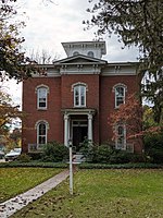
The Sacred Grove is a forested area of western New York near the home of Joseph Smith where the foundational event of the Latter Day Saint movement took place. It is the location where Smith said he had his First Vision, a theophany, occurring in the spring of 1820. The exact location of the Sacred Grove is not known, but it would likely have been west of Smith's adolescent home on the border of the towns of Palmyra and Manchester. This area was being cleared at the time for farming by the Smith family, who were also using the trees to harvest maple syrup. The area has been purchased by the Church of Jesus Christ of Latter-day Saints (LDS Church), which cares for the area and allows tourists to visit. Latter Day Saints view the place as a sacred site. The Sacred Grove was ranked the No. 74 Most Holy Place on Earth by religious leaders, writers and scholars in the Patheos multi-faith religion project Sacred Spaces: The 100 Most Holy Places on Earth.

Excerpt from the Wikipedia article Sacred Grove (Latter Day Saints) (License: CC BY-SA 3.0, Authors, Images).

Sacred Grove (Latter Day Saints)
Annenstraße, Dresden Wilsdruffer Vorstadt (Altstadt)

Geographical coordinates (GPS) Address Nearby Places
placeShow on map

Wikipedia: Sacred Grove (Latter Day Saints)Continue reading on Wikipedia

Geographical coordinates (GPS)

Latitude Longitude
N 43.040669 ° E -77.244404 °
placeShow on map

Address

Annenstraße 24
01067 Dresden, Wilsdruffer Vorstadt (Altstadt)
Sachsen, Deutschland
mapOpen on Google Maps

Sacred Grove (1907)
Sacred Grove (1907)
Share experience

Nearby Places

Palmyra Village Historic District

Palmyra Village Historic District is a national historic district at Palmyra in Wayne County, New York. The district includes 207 contributing buildings, 2 contributing sites, 7 contributing structures, and 1 contributing object. It encompasses Palmyra's commercial, civic, religious, and residential core. Most of the buildings were built between about 1830 and 1890, and is representative of a quintessential canal town in New York State. It includes the previously listed Market Street Historic District, East Main Street Commercial Historic District, and Zion Episcopal Church. New areas in the district are the Palmyra Village Civic Center Area, Four Churches Area, Swift Cemetery Area, Residential West Main Street, Palmyra Elementary School Area, Residential Cuyler Street and East and West Jackson Street, The Fairgrounds, and Residential East Main Street. Notable buildings include the Village Hall (1866-1868), Griffith Block (c. 1893), First National Bank (1925), bandstand on the village green (c. 1906), First Methodist Church (1866-1867), Western Presbyterian Church (c. 1832), First Baptist Church (1871), St. Anne's Roman Catholic Church (1859-1870s), Alexander McKachnie House (c. 1830), Garlock Office Building, Sherburne Ford building (c. 1910), Palmyra Elementary School (1924), the Carlton Rogers House (1850s), and the Floral Hall (1856).It was listed on the National Register of Historic Places in 2009.