place

Steele Brothers Dairy Ranches

1850 establishments in California1850 in CaliforniaCalifornia Historical LandmarksHistory of San Mateo County, California
SOUTHWEST FRONT AND SOUTHEAST SIDE Steele Brothers Dairies, Cascade Ranch House, Pescadero, San Mateo County, CA HABS CAL,41 PESC.V,2 B 1

Steele Brothers Dairy Ranches is a historical site in Pescadero, California in San Joaquin County. Steele Brothers Dairy Ranches site is a California Historical Landmark No. 906 listed on February 8, 1977. The Steele Brothers: Edgar W. Steele, Isaac C. Steele, and Rensselaer E. Steele, were the pioneers of larger scale Dairy farming. Steele Brothers from Delaware, had large-scale commercial cheese and dairy plants. Steele Brothers operated 7,000-acre ranch with five dairies. The ranch ran from Gazos Creek on the north to Point Año Nuevo on the south, about 5 miles on the along the Coastal California, between the Pacific Ocean and Big Basin Redwoods. The five dairies were has far north as Point Reyes and as south as the one at Gazos Creek near Rancho Punta del Año Nuevo. The Steele Brothers operated from 1850 to 1950. A historical marker was placed in 1982 by the California State Department of Parks and Recreation working with the Año Nuevo Interpretive Association. The marker is on Cabrillo Highway at New Year's Creek Road. The Old Steele Dairy Barn is now the Marine Education Center at Año Nuevo State Park.

Excerpt from the Wikipedia article Steele Brothers Dairy Ranches (License: CC BY-SA 3.0, Authors, Images).

Steele Brothers Dairy Ranches
Steele Trail,

Geographical coordinates (GPS) Address Nearby Places
placeShow on map

Wikipedia: Steele Brothers Dairy RanchesContinue reading on Wikipedia

Geographical coordinates (GPS)

Latitude Longitude
N 37.119 ° E -122.307 °
placeShow on map

Address

Steele Trail

California, United States
mapOpen on Google Maps

SOUTHWEST FRONT AND SOUTHEAST SIDE Steele Brothers Dairies, Cascade Ranch House, Pescadero, San Mateo County, CA HABS CAL,41 PESC.V,2 B 1
Share experience

Nearby Places

CZU Lightning Complex fires

The CZU Lightning Complex fires were wildfires that burned in Northern California starting in August 2020. The fire complex consisted of fires in San Mateo and Santa Cruz counties, including fires that had previously been separately tracked as the Warnella and Waddell fires. The firefighting effort was primarily administered by the California Department of Forestry and Fire Protection (Cal Fire).The first fires started around 3:30 A.M. on August 16, 2020, the result of a thunderstorm that produced close to 11,000 bolts of lightning and started hundreds of fires throughout California. These lightning strikes initially started fires separately known as the Warnella Fire, near Davenport and the Waddell Fire, near Waddell Creek, as well as three fires on what would become the northern edge of the CZU Complex fire. Two days after the fires began, a change in wind conditions caused these three northern fires to rapidly expand and merge, growing quickly to over 40,000 acres.The fires destroyed 1,490 buildings, including in the communities of Boulder Creek, Bonny Doon, Swanton, and along Empire Grade Road. Fires burned in both Butano and Big Basin Redwoods state parks, where a number of historic buildings were destroyed, including the visitor's center at Big Basin.On September 22, Cal Fire reported that the complex, which had covered 86,509 acres (35,009 ha), had been fully contained On December 23 Cal Fire announced that the fire was controlled, stating that the fire was fully extinguished and has no risk of reignition. However, it was later discovered that the fire was not quite completely extinguished; redwoods continued to smolder well into 2021. The abbreviation "CZU" refers to the Cal Fire designation for its San Mateo–Santa Cruz Unit, the administrative division for San Mateo, Santa Cruz and San Francisco counties.One person died in the fires, and one other was injured.The documentary The CZU Fire In Their Own Words – Fighting Fires, Losing Homes, and Rebuilding Community covers the fires and was created and directed by Boulder Creek resident Peter Gelblum .

Skyline-to-the-Sea Trail

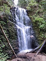
The Skyline-to-the-Sea Trail is a 29.5-mile (47.2-kilometre) hiking trail that descends from the ridge of the Santa Cruz Mountains in California to the Pacific Ocean, passing through Castle Rock State Park and Big Basin Redwoods State Park. Big Basin is California's oldest state park. It contains beautiful waterfalls and some of the largest, tallest, and oldest Redwood forests left in existence. After the August 2020 CZU Lightning Complex fires, the trail closed, along with much of Big Basin Redwoods State Park. As of December 2021, the trail remains closed and its future is unclear.The trail usually takes two to three days to complete, with nearly all thru-hikers traveling from East to West (towards the ocean). It is possible to walk the entire trail in one day, though this is unusual and very difficult. However, there is a 50-km (31-mi) ultra running race held on this trail one or two times per year. Many hikers like to take a detour up Berry Creek Trail to see the waterfalls or to camp at Sunset Trail Camp, adding 2.7 mi (4.3 km) to the hike. The trail begins at Saratoga Gap on the ridge at the intersection of SR 9 and Skyline Boulevard (SR 35), although many hikers actually begin at Castle Rock due to its overnight parking facility. The trail parallels SR 9 through Castle Rock, crosses the highway, and then follows SR 236 to Big Basin park headquarters. It then descends through Big Basin, following Waddell Creek to its outlet at Waddell Beach. Santa Cruz Metro routes 35 and 40 formerly went from Big Basin State Park Headquarters to Waddell Creek and back. Since September 2011, Route 40 no longer goes all the way to Waddell Beach from mid-December to mid-March. but instead turns around at Cement Plant Rd. Route 35 formerly stopped at Big Basin Headquarters on the weekends during the Spring/Summer season. As of October 2020, there is 3.6 mile (5.8 km) extension that creates a "Saratoga-to-the-Sea" Trail. The trail originates at Saratoga Quarry Park, and terminates at Sanborn-Skyline County Park. This trail connects to the Skyline-to-the-Sea Trail via a completed section of the Bay Area Ridge Trail. The park is owned by the city of Saratoga's Parks Department.