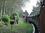
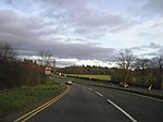
Dowles
Former civil parishes in WorcestershireHamlets in WorcestershireWorcestershire geography stubsWyre Forest District

Dowles is a hamlet in the civil parish of Upper Arley, in the Wyre Forest district, in the county of Worcestershire, England. It is about 3 miles from the town of Kidderminster. The parish was divided into two parts by the Severn.
Excerpt from the Wikipedia article Dowles (License: CC BY-SA 3.0, Authors, Images).Dowles
Dowles Road, Wyre Forest
Geographical coordinates (GPS) Address Nearby Places Show on map
Geographical coordinates (GPS)
| Latitude | Longitude |
|---|---|
| N 52.3857 ° | E -2.3306 ° |
Address
Dowles Road
Dowles Road
DY12 3AF Wyre Forest
England, United Kingdom
Open on Google Maps


