Dowles Brook
England river stubsRivers of WorcestershireSevern drainage basinTributaries of the River SevernUse British English from March 2018 ... and 1 more
Worcestershire geography stubs

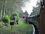
Dowles Brook flows through the heart of the Wyre Forest, into the former civil parish of Dowles and into the River Severn.
Excerpt from the Wikipedia article Dowles Brook (License: CC BY-SA 3.0, Authors, Images).Dowles Brook
Dowles Road, Wyre Forest
Geographical coordinates (GPS) Address Nearby Places Show on map
Geographical coordinates (GPS)
| Latitude | Longitude |
|---|---|
| N 52.385 ° | E -2.3247222222222 ° |
Address
Dowles Road
Dowles Road
DY12 2RG Wyre Forest
England, United Kingdom
Open on Google Maps


