place

Amsweer

EemsdeltaPages with Dutch IPAPages with non-numeric formatnum argumentsPopulated places in Groningen (province)

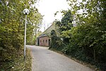
Amsweer (Dutch pronunciation: [ɑmsˈʋeːr]) is a hamlet on a small wierde in the municipality of Eemsdelta in the province of Groningen in the Netherlands, just south of the Eemskanaal. There used to be a drinking water pond on the wierde that never dried up. There were three brick wells in that pond, which were called the zusterputten ('sister wells') or jufferputten ('damsel wells'). These wells provided drinking water, which was particularly welcome in dry summers when the water in the surrounding ditches began to salinize. Three single ladies who lived in a house together are said to have built the wells. There was a small school building near the wells around 1820. The wells were filled in in 1911. Despite its small size, Amsweer was a busy hamlet in the 19th century. There were carpentries, carriage factories, and glass-bending factories.The wierde is first mentioned as Omptsweer (1448) and Amptesweer (1449), perhaps in the meaning 'the mound of the office (here apparently: the Oosterambt of Fivelingo)'.The country estate or borg of Vliethoven is located about 2 kilometers north of Amsweer, in the Tuikwerd district. Due to the presence of the Eemskanaal, the country estate can only be reached from Amsweer via a long detour via Opwierde.

Excerpt from the Wikipedia article Amsweer (License: CC BY-SA 3.0, Authors).

Amsweer
Amsweersterweg, Eemsdelta

Geographical coordinates (GPS) Address Nearby Places
placeShow on map

Wikipedia: AmsweerContinue reading on Wikipedia

Geographical coordinates (GPS)

Latitude Longitude
N 53.30852 ° E 6.90224 °
placeShow on map

Address

Amsweersterweg 14
9937 TD Eemsdelta
Groningen, Netherlands
mapOpen on Google Maps

Share experience

Nearby Places

Appingedam
Appingedam

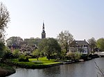
Appingedam (Dutch: [ˌɑpɪŋəˈdɑm] ; Gronings: n Daam [n̩ˈdaːm]) is a city and former municipality in the northeastern Netherlands. Although there is no certainty as to the exact age of Appingedam, historical research demonstrates that the place in which the city would eventually be built had been inhabited for over a millennium. Specifically, the area in which the earliest traces of human settlements have been reported is the Wierde, a quarter located in the northern part of the city centre. Today, a narrow, winding street by the same name runs along the waterfront as a living testimony to the times gone by. The characteristic landmarks of the old Wierde are still recognisable today: the historical East-West Canal, called “Diep,” dug to the south of the Wierde, diked on both sides, still defines the unique layout of the downtown Appingedam. Little is known about the exact age and origin of the name of Appingedam. It came into existence on the banks of the Delf, the present Damsterdiep, around 1200. The name originates from a dam built in the Appe or Apt. In 1327, Appingedam received city rights from the free Frisians of the Upstalboom near the East Frisian city of Aurich. Appingedam and Aurich still have friendly liaisons via a partnership called the Städtepartnerschaft or stedenband, in German and Dutch respectively. Appingedam is located in the region Fivelingo, which in the Middle Ages was a part of Frisia. In the Late Middle Ages, Appingedam, being a seaport, was an important trading competitor to Groningen. When Groningen received the staple right, Appingedam rapidly lost its trading position. Later on Delfzijl outstripped Appingedam with its newer and bigger seaport. Nowadays Appingedam still looks indispensable as a small city. Many original medieval premises can be found in the centre. The most famous sight is the hanging kitchens above the Damsterdiep. Appingedam was home to the Appingedammer Bronsmotorenfabriek that produced large ship's engines for the shipyards in the area.