place

Weiwerd

1970s disestablishments in the NetherlandsEemsdeltaFormer populated places in the NetherlandsPages with Dutch IPAPages with Gronings IPA
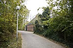
Weiwerd boerderij Karspelpad

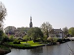
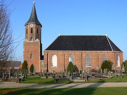
Weiwerd (Dutch pronunciation: [ˈʋɛiʋərt]; Gronings: Waaiwerd [ˈʋɑːɪ̯ʋət]) is a former village in the Dutch province of Groningen. It is a part of the municipality of Eemsdelta, and lies about 27 km east of Groningen.Formerly a farming community with its own church, school, and shops, the whole village was scheduled for demolition in the 1970s to allow the industrial area of Delfzijl harbour to be expand. Less than 10% of the original buildings are left. The school and the cemetery have remained. The terp (artificial living hill) was supposed to be excavated as well, however protests have prevented its destruction, and the terp is now a protected monument.

Excerpt from the Wikipedia article Weiwerd (License: CC BY-SA 3.0, Authors, Images).

Weiwerd
Oosterhorn, Eemsdelta

Geographical coordinates (GPS) Address Nearby Places
placeShow on map

Wikipedia: WeiwerdContinue reading on Wikipedia

Geographical coordinates (GPS)

Latitude Longitude
N 53.316666666667 ° E 6.95 °
placeShow on map

Address

Oosterhorn
9936 HK Eemsdelta
Groningen, Netherlands
mapOpen on Google Maps

Weiwerd boerderij Karspelpad
Share experience

Nearby Places

Appingedam
Appingedam

Appingedam (Dutch: [ˌɑpɪŋəˈdɑm] ; Gronings: n Daam [n̩ˈdaːm]) is a city and former municipality in the northeastern Netherlands. Although there is no certainty as to the exact age of Appingedam, historical research demonstrates that the place in which the city would eventually be built had been inhabited for over a millennium. Specifically, the area in which the earliest traces of human settlements have been reported is the Wierde, a quarter located in the northern part of the city centre. Today, a narrow, winding street by the same name runs along the waterfront as a living testimony to the times gone by. The characteristic landmarks of the old Wierde are still recognisable today: the historical East-West Canal, called “Diep,” dug to the south of the Wierde, diked on both sides, still defines the unique layout of the downtown Appingedam. Little is known about the exact age and origin of the name of Appingedam. It came into existence on the banks of the Delf, the present Damsterdiep, around 1200. The name originates from a dam built in the Appe or Apt. In 1327, Appingedam received city rights from the free Frisians of the Upstalboom near the East Frisian city of Aurich. Appingedam and Aurich still have friendly liaisons via a partnership called the Städtepartnerschaft or stedenband, in German and Dutch respectively. Appingedam is located in the region Fivelingo, which in the Middle Ages was a part of Frisia. In the Late Middle Ages, Appingedam, being a seaport, was an important trading competitor to Groningen. When Groningen received the staple right, Appingedam rapidly lost its trading position. Later on Delfzijl outstripped Appingedam with its newer and bigger seaport. Nowadays Appingedam still looks indispensable as a small city. Many original medieval premises can be found in the centre. The most famous sight is the hanging kitchens above the Damsterdiep. Appingedam was home to the Appingedammer Bronsmotorenfabriek that produced large ship's engines for the shipyards in the area.