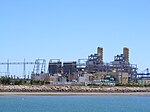
Pelican Point, Adelaide
Adelaide geography stubsHeadlands of South AustraliaLefevre Peninsula

Pelican Point is at the northern tip of Lefevre Peninsula, adjacent to the Port River shipping channel and the container terminal and associated infrastructure at Outer Harbor. A non-residential area, it is undergoing considerable industrial development, which is expected to continue as other projects, such as the Port River Expressway, come to fruition. Light Passage, named after founder of Adelaide Colonel William Light, lies in the Port Adelaide River between Pelican Point and Torrens Island.There is a ship's graveyard site at the northern end of Mutton Cove, near Pelican Point, there being a steel hulk of a steamship on the beach.
Excerpt from the Wikipedia article Pelican Point, Adelaide (License: CC BY-SA 3.0, Authors, Images).Pelican Point, Adelaide
Pelican Point Road, Adelaide Outer Harbor
Geographical coordinates (GPS) Address Nearby Places Show on map
Geographical coordinates (GPS)
| Latitude | Longitude |
|---|---|
| N -34.763 ° | E 138.505 ° |
Address
Pelican Point Road
Pelican Point Road
5018 Adelaide, Outer Harbor
South Australia, Australia
Open on Google Maps


