place

Pelican Point Power Station

Buildings and structures in AdelaideEconomy of AdelaideLefevre PeninsulaNatural gas-fired power stations in South AustraliaUse Australian English from April 2015
Pelican Point power station

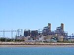
The Pelican Point Power Station is located at Pelican Point, 20 km from the centre of Adelaide, South Australia on the Lefevre Peninsula. It is operated by Engie (previously known as GDF Suez Australian Energy), which owns 72 per cent of the power station. Mitsui owns the remaining 28 per cent. It burns natural gas in a combined cycle power station, comprising two 160 MW gas turbines and one 165 MW steam turbine, to generate up to 485 MW of electricity.Construction began in 1999. The plant has two GT13E2 gas turbines manufactured by ABB (now Alstom). The plant, including steam turbine and heat recovery steam generator (HRSG), was manufactured and constructed by ABB. Fuel is supplied via either the SEAGas pipeline, which runs from the Iona Gas Plant in Victoria to the Pelican Point power station, or the Moomba Adelaide Pipeline System (MAPS), which supplies gas from Moomba to Adelaide.

Excerpt from the Wikipedia article Pelican Point Power Station (License: CC BY-SA 3.0, Authors, Images).

Pelican Point Power Station
Pelican Point Road, Adelaide Outer Harbor

Geographical coordinates (GPS) Address Nearby Places
placeShow on map

Wikipedia: Pelican Point Power StationContinue reading on Wikipedia

Geographical coordinates (GPS)

Latitude Longitude
N -34.763055555556 ° E 138.505 °
placeShow on map

Address

Pelican Point Road

Pelican Point Road
5018 Adelaide, Outer Harbor
South Australia, Australia
mapOpen on Google Maps

Pelican Point power station
Share experience

Nearby Places

Barker Inlet
Barker Inlet

The Barker Inlet is a tidal inlet of the Gulf St Vincent in Adelaide, South Australia, named after Captain Collet Barker who first sighted it in 1831. It contains one of the southernmost mangrove forests in the world, a dolphin sanctuary, seagrass meadows and is an important fish and shellfish breeding ground. The inlet separates Torrens Island and Garden Island from the mainland to the east, and is characterised by a network of tidal creeks, artificially deepened channels, and wide mudflats. The extensive belt of mangroves are bordered by samphire saltmarsh flats and low-lying sand dunes. There are two boardwalks (at Garden Island and St Kilda), and ships graveyards in Broad Creek, Angas Inlet and the North Arm (which is just south of North Arm Creek). The Eastern Passage runs between Garden Island and the mainland, narrowing to form Angas Channel north of North Arm Creek. The inlet has been adversely impacted since the settlement of South Australia, with stormwater and raw sewage discharge, fishing, landfill rubbish dumping, power generation and other activities adversely affecting its flora and fauna. Much of this has changed with the landfill dump on adjacent Garden Island being closed in 2000 and remediation work begun. Some stormwater is now being filtered through wetlands before discharge and the inlet has been declared a reserve for the preservation of dolphins, fish, crabs and aquatic plants. The mangroves and waterways are still affected by the adjacent former salt crystallization pans (closed in 2014), hot wastewater discharge from Torrens Island power station, heavy metal contamination from stormwater and treated sewage, and disturbances from boat traffic.