place

Riverstone International School

Boarding schools in IdahoEducation in Boise, IdahoInternational Baccalaureate schools in IdahoPrivate elementary schools in IdahoPrivate high schools in Idaho
Private middle schools in IdahoSchools in Ada County, Idaho

Riverstone International School is a private, independent school for preschool through high school students in Boise, Idaho that offers day and boarding programs. Riverstone was the first International Baccalaureate World School in Idaho and is one of a small number of schools in the United States to offer all three IB programs, the Primary Years Programme (PYP), Middle Years Programme (MYP), and the Diploma Programme (DP). The school’s Five Pillars—Academic Excellence, Community and Service, Leadership by Example, International Understanding and Outdoor Education—provide pathways for students to explore academically and personally. Students raft the Main Payette River and Main Salmon River and backpack through the White Cloud and Sawtooth Mountains. The school's boarding program enrolls a maximum of 30 students from the U.S. and around the world. The school community as a whole includes representation from 45+ countries, including Australia, Bulgaria, China, Ethiopia, France, Germany, India, Italy, Korea, Mexico, Russia, Spain, Ukraine and Vietnam. Riverstone is a Malone Family Foundation supported school.Riverstone International School is a not-for-profit organization under the Internal Revenue Code Classification 501(c)(3).

Excerpt from the Wikipedia article Riverstone International School (License: CC BY-SA 3.0, Authors).

Riverstone International School
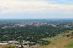
East Warm Springs Avenue, Boise

Geographical coordinates (GPS) Address Website External links Nearby Places
placeShow on map

Wikipedia: Riverstone International SchoolContinue reading on Wikipedia

Geographical coordinates (GPS)

Latitude Longitude
N 43.564722222222 ° E -116.115 °
placeShow on map

Address

Riverstone International School

East Warm Springs Avenue 5521
83716 Boise
Idaho, United States
mapOpen on Google Maps

Website
riverstoneschool.org

linkVisit website

linkWikiData (Q7338655)
linkOpenStreetMap (663000311)

Share experience

Nearby Places

Oregon Trail (Ada County, Idaho segment)

The Oregon Trail (Ada County, Idaho segment) near Boise, Idaho, includes approximately eight miles of the Oregon Trail as it entered the Boise Valley. The segment was added to the National Register of Historic Places (NRHP) in 1972. At the time of the NRHP nomination, wagon tracks from the Oregon Trail could be identified almost continuously from the northwest and northeast quadrants of Section 36, Range 2 East, Township 2 North through the northwest and northeast quadrants of both Section 31, Range 3 East, Township 2 North and Section 24, Range 3 East, Township 1 North. In places along the segment the wagon tracks were eight tracks wide. The length of the segment is roughly from 43.56055556°N 116.15527778°W / 43.56055556; -116.15527778 to 43.5143915°N 116.1526384°W / 43.5143915; -116.1526384.The Oregon Trail Reserve is a 77-acre site managed by Boise Parks and Recreation, and the area includes part of the Oregon Trail segment designated by the NRHP in 1972. Nearby is the Oregon Trail Recreation Area, another part of the NRHP segment managed by Boise Parks and Recreation.Although the Oregon Trail followed the segment identified in the NRHP listing, it then continued along the route of what is now Boise Avenue. The Capitol Boulevard Memorial Bridge, also known as the Oregon Trail Memorial Bridge, is located where the Oregon Trail crossed the Boise River by ferry and proceeded through Boise City west toward Caldwell. A series of 21 obelisks now mark the route of the Oregon Trail through Boise.

Table Rock (Ada County, Idaho)

Table Rock is a mountain pillar in the western United States, located just south-east of downtown Boise, Idaho, in the foothills of the Boise Range of the Rocky Mountains. Its summit elevation of 3,650 feet (1,115 m) above sea level is 900 feet (275 m) above the city center. Located between downtown Boise and the foothills, table rock is a rock surface with multiple caves and ledges and overlooks the treasure valley area, which makes it a safe yet adventurous location for people of all ages.A prominent local landmark, it is a popular spot for day hiking from the Old State Penitentiary which offers access to views of the Treasure Valley, Owyhee Mountains, and the Boise Foothills themselves. Trailhead access and parking is behind the Bishop's House in the Penitentiary Historic District. The Idaho State Historical Society manages Table Rock Mesa. Table Rock is open to foot and bike traffic from sunrise to sunset. Please check trail conditions before planning your hike. A gate is installed on Table Rock Road to prevent vehicle access.An illuminated sixty-foot (18 m) white cross at its summit has been the subject of a lawsuit involving the separation of church and state (the cross itself stands on four square feet (0.4 m2) of land sold to the Jaycees for $100 in 1972, hence it stands on private property). The legality of the land sale to the Jaycees is disputed, as the land board meeting minutes, which discuss the sale, indicate that the sale was structured specifically to sell the land to the Jaycees for the purpose of insulating the cross from legal attack. The sale included language that allowed the Land Board to reject any offers, with the stated intent of rejecting offers other than from the Jaycees. The Table Rock Mesa was first quarried in the 1860s with much of the sandstone around Boise coming from Table Rock, including the Old Idaho Penitentiary. It continues to be an active quarry today. In 2016, illegal fireworks usage on Table Rock shortly after midnight on June 30 initiated a 2,500-acre (10 km2) wildfire.

Olson City, Idaho
Olson City, Idaho

Olson City, Idaho was an early- and mid-20th century industrial park in southeast Boise named after L. G. Olson, president and general manager of Olson Manufacturing Co. The firm, founded in Ontario, Oregon 1910 but based in Boise since 1920, established a new manufacturing plant near the old sandstone quarry southeast of the Idaho State Penitentiary and Table Rock, 1 mi (1.609 km) east of the famous (and also long since defunct) Nanatorium, on the road to Arrowrock Dam. Situated by the Boise River, the company manufactured and serviced a wide range of industrial goods, including mining machinery, steelworks, oil equipment, irrigation infrastructure, storage tanks, ditchers, and the like. In 1940, when the Olson Company acquired the holdings of the venerable Boise Stone Company, a workman climbed up a chimney and painted in red paint "Olson City"; the campus and the company thus became conterminous. Not a company town, the Idaho Sunday Statesman often covered Olson City: around-the-clock war production in 1943 (which necessitated an additional railway spur line), Morrison-Knudsen's purchase of a controlling interest in (the company) in late 1943, and the employment of "feminine steelworkers" in May 1945. In November 1945 the Olson Co. took out a full-page ad in the statesman detailing the war material it had produced. On December 6, 1946 it was announced that the Olson Manufacturing Co. had bought the entire inventory and part of the machinery of Idaho Steel Products Company, which had been in existence for three years. The company fabricated steel lining for the Lucky Peak Dam diversion tunnel in 1950. The Omaha, Nebraska firm Gate City Steel bought "Olson City" sometime prior to January 1961, and by May 1962 the putative city, once known throughout the Northwest, was as a distinct entity was a matter of remembrance, having been subsumed by Bannock Steel Group. Little trace of it remains, to the extent that on contemporary maps part of the area is labeled "Vernon" (a small subdivision confusingly called Warm Springs Village). Several of the Ridge to Rivers foothill hiking trails thread the area, including the 3,828 ft (1.167 km) #14 Tram Trail.