Hood Brook
Derbyshire geography stubsDerwent (Derbyshire) catchmentEngland river stubsHigh Peak, DerbyshireRivers and valleys of the Peak District ... and 3 more
Rivers of DerbyshireTourist attractions in DerbyshireUse British English from May 2023

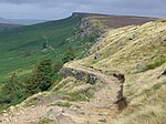
Hood Brook is a stream in the Derbyshire Peak District, originating near Stanage Edge, close to Robin Hoods Cave.
Excerpt from the Wikipedia article Hood Brook (License: CC BY-SA 3.0, Authors, Images).Hood Brook
Baulk Lane, Derbyshire Dales
Geographical coordinates (GPS) Address Nearby Places Show on map
Geographical coordinates (GPS)
| Latitude | Longitude |
|---|---|
| N 53.336388888889 ° | E -1.6555555555556 ° |
Address
Baulk Lane
Baulk Lane
S32 1AF Derbyshire Dales
England, United Kingdom
Open on Google Maps


