place

Offerton, Derbyshire

Derbyshire DalesDerbyshire geography stubsHamlets in DerbyshireTowns and villages of the Peak District
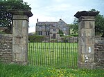
Offerton Hall Geograph 2637671 by Graham Hogg

Offerton is a hamlet and civil parish in the Derbyshire Dales district, in Derbyshire, England. It lies on the River Derwent. The village features Offerton House, a Grade II* listed building and the nearby Offerton Hall, also Grade II* listed.

Excerpt from the Wikipedia article Offerton, Derbyshire (License: CC BY-SA 3.0, Authors, Images).

Offerton, Derbyshire
Derbyshire Dales

Geographical coordinates (GPS) Address Nearby Places
placeShow on map

Wikipedia: Offerton, DerbyshireContinue reading on Wikipedia

Geographical coordinates (GPS)

Latitude Longitude
N 53.324 ° E -1.681 °
placeShow on map

Address


S32 1AX Derbyshire Dales
England, United Kingdom
mapOpen on Google Maps

Offerton Hall Geograph 2637671 by Graham Hogg
Share experience

Nearby Places

River Noe
River Noe

The River Noe is a tributary of the River Derwent in Derbyshire, England. It flows approximately 12 miles (19 km) from its source, the confluence of two streams running off Kinder Scout in the Peak District, east through Edale and then southeast through the village of Hope. The river's source is at Edale Head from where it runs down the clough alongside Jacob's Ladder footpath and through the Vale of Edale. The river flows into the River Derwent a kilometre south of Bamford. The entire length of the river is closely followed by the Hope Valley (Manchester to Sheffield) railway line. The portion of the river downstream of Hope, along with the valley of the River Noe's main tributary, Peakshole Water, is known as the Hope Valley.Like many rivers in Derbyshire, the Noe was used historically to power water mills, originally these were mainly corn mills but during the industrial revolution some were rebuilt for other uses. One example of this was the cotton mill at Edale; built in the late 18th century it shares a common design with other mills of the period, including multiple floors with large windows and a shallow pitched roof. There was also a corn and saw mill at Hope, driven by an 11 ft water wheel.At Brough there were a number of mills that used the Noe, including a lace-thread doubling mill, a cotton mill and the corn mill (pictured). The corn mill is notable in that water-powered milling came to an end in 1954, when the flow of the Noe was reduced by the upstream diversion scheme. This was constructed to provide additional inflows for Ladybower Reservoir by the Derwent Valley Water Board.The Romans established Navio fort overlooking a tight bend on the River Noe at Brough, which means fort in Old English.

Eyam Moor
Eyam Moor

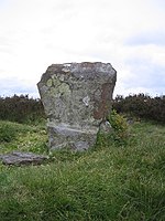
Eyam Moor is a plateau-topped hill between the villages of Eyam and Hathersage in Derbyshire, in the Peak District of England. The summit of Sir William Hill is 429 metres (1,407 ft) above sea level.It is unclear whom Sir William Hill is named after. Candidates include the four Dukes of Devonshire called Sir William Cavendish, Sir William Saville (Lord of the Manor of Eyam) and Sir William Bagshaw (High Sheriff for Derbyshire in 1805). The radio mast on top of Sir William Hill is a prominent local landmark. Sir William Hill Road is an ancient packhorse route across the moor and was part of the Sheffield to Buxton Turnpike of 1758. The Barrel Inn on Sir William Hill Road at Bretton is the highest pub in Derbyshire. There are three stone circles on Eyam Moor. Wet Withens (known as Eyam Moor 1) is a Bronze Age stone circle at the centre of Eyam Moor with an earthen bank over 30m wide. The prehistoric henge of 10 upright stones (orthostats) is a protected Scheduled Monument. The other embanked stone circle (Eyam Moor 2) on the eastern edge of the moor is also Bronze Age and is about 13m across. Nearby is Eyam Moor 3, a third Bronze Age small circle of 13m diameter with six remaining free-standing stones, without an embankment. Both of these smaller henges are also Scheduled Monuments, as well as numerous prehistoric cairns spread across the moor. Ladywash Mine on the southern edge of Eyam Moor was an old lead mine and was also used to produce fluorspar for the steel industry between 1936 and 1979.Following the Countryside and Rights of Way Act 2000, this gritstone moorland plateau became "Open Access" land for the public. There are footpaths across the moor, leading from roadside car parking on Sir William Hill Road between Eyam and Grindleford.

Wet Withens
Wet Withens

Wet Withens is a Bronze Age henge on Eyam Moor in the Derbyshire Peak District, England. The prehistoric circle of 10 upright stones (orthostats) is a protected Scheduled Monument.It is sometimes known as Wet Withers (Old English for 'the wet land where willows grew').On gritstone moorland over 300 metres above sea level, the site has clear views of the valley of the River Derwent and Higger Tor. The site is well away from public footpaths but is on "Open Access" land following the Countryside and Rights of Way Act 2000. The earthen bank of Wet Withens is over 30m in diameter, making it the largest embanked stone circle in Derbyshire. Most of the stones of the ring are quite hidden amongst the heather and reeds. 7 stones are still upright but some of those are leaning inwards. The 'Chair Stone' (70cm high) is the tallest and most prominent stone with a ledge cut out of its face, appearing as a seat. There could have been up to 18 stones originally if the stones had been spaced out evenly.About 10m north of the henge is a large stone cairn (known as Eyam Moor Barrow) about 27m long and 1m high. The cairn has been damaged from quarrying and/or excavation activity over the centuries. Near the middle of the cairn is an unusual cup-marked stone. The cairn's shape indicates that it was likely to have been a prehistoric burial barrow.Wet Withens is also known as Eyam Moor 1 because there are 2 smaller stone circles about 650m to the east, which are also Scheduled Monuments: Eyam Moor 2 and Eyam Moor 3.There are a number of other ancient henges in Derbyshire including Arbor Low, The Bull Ring, Doll Tor, Hordron Edge, Nine Stone Close and Twyford Henge.