Weststadt, Heidelberg
Geography of Heidelberg

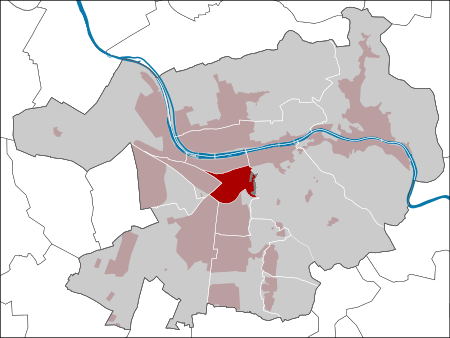
Weststadt ("West City") is a suburb of Heidelberg created during the 19th century, when Heidelberg expanded to the west along the railways during the Industrial Revolution. The development of Weststadt into the first suburb at the base of the Gaisberg hill is closely connected with Heidelberg's development into a metropolis. Following further expansion, the new suburbs of Südstadt and Bahnstadt were created to the south and west respectively. The central square is Wilhelmsplatz, which is used for regular events, daily recreation and a farmer's market on Mondays and Thursdays.
Excerpt from the Wikipedia article Weststadt, Heidelberg (License: CC BY-SA 3.0, Authors, Images).Weststadt, Heidelberg
Dantestraße, Heidelberg Weststadt (Weststadt)
Geographical coordinates (GPS) Address Nearby Places Show on map
Geographical coordinates (GPS)
| Latitude | Longitude |
|---|---|
| N 49.4 ° | E 8.6833333333333 ° |
Address
Dantestraße 57
69115 Heidelberg, Weststadt (Weststadt)
Baden-Württemberg, Germany
Open on Google Maps


