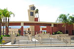
Corona Municipal Airport
Airports in Riverside County, CaliforniaBuildings and structures in Corona, CaliforniaTransportation in Corona, CaliforniaVague or ambiguous time from August 2020
Corona Municipal Airport (ICAO: KAJO, FAA LID: AJO), formerly L66, is three miles northwest of Downtown Corona, serving Riverside County, California, United States. The airport has a few businesses, such as a cafe, "Flying Academy" flight training center, and aircraft maintenance and repair.Most U.S. airports use the same three-letter location identifier for the FAA and IATA, but Corona Municipal Airport is AJO to the FAA and has no IATA code (Aljouf, Yemen has IATA code AJO).
Excerpt from the Wikipedia article Corona Municipal Airport (License: CC BY-SA 3.0, Authors).Corona Municipal Airport
Aviation Drive, Corona
Geographical coordinates (GPS) Address Phone number External links Nearby Places Show on map
Geographical coordinates (GPS)
| Latitude | Longitude |
|---|---|
| N 33.897777777778 ° | E -117.6025 ° |
Address
Corona Municipal Airport
Aviation Drive 1900
92880 Corona
California, United States
Open on Google Maps


