Nico Ditch
Ancient dikesEngvarB from September 2017Geography of ManchesterGeography of TamesideGeography of Trafford ... and 5 more
Geography of the Metropolitan Borough of StockportHistory of Greater ManchesterHistory of ManchesterLinear earthworksScheduled monuments in Greater Manchester

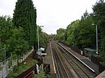
Nico Ditch is a six-mile (9.7 km) long linear earthwork between Ashton-under-Lyne and Stretford in Greater Manchester, England. It was dug as a defensive fortification, or possibly a boundary marker, between the 5th and 11th century. The ditch is still visible in short sections, such as a 330-yard (300 m) stretch in Denton Golf Course. For the parts which survived, the ditch is 4–5 yards (3.7–4.6 m) wide and up to 5 feet (1.5 m) deep. Part of the earthwork is protected as a Scheduled Ancient Monument.
Excerpt from the Wikipedia article Nico Ditch (License: CC BY-SA 3.0, Authors, Images).Nico Ditch
Bratton Drive, Manchester Levenshulme
Geographical coordinates (GPS) Address Nearby Places Show on map
Geographical coordinates (GPS)
| Latitude | Longitude |
|---|---|
| N 53.4508 ° | E -2.1769 ° |
Address
Bratton Drive
Bratton Drive
M19 3ET Manchester, Levenshulme
England, United Kingdom
Open on Google Maps


