place

Pelham, Ontario

Lower-tier municipalities in OntarioMunicipalities in the Regional Municipality of NiagaraTowns in OntarioUse Canadian English from January 2023
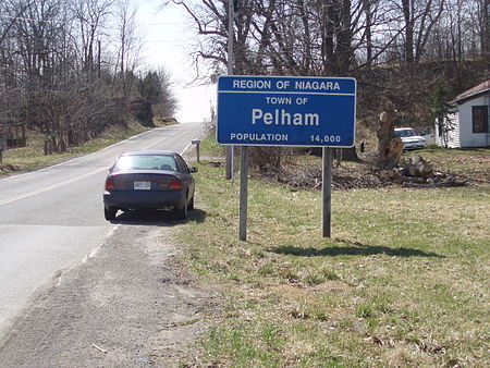
Pelham place sign
Pelham place sign

Pelham (2016 population 17,110) is a town located in the centre of Niagara Region in Ontario, Canada. The town's southern boundary is formed by the Welland River, a meandering waterway that flows into the Niagara River. To the west is the township of West Lincoln, to the east the city of Welland and the city of Thorold, and to the north the city of St. Catharines and the town of Lincoln. North Pelham contains the picturesque Short Hills (see attractions). Two important creeks have their headwaters within Pelham; Coyle Creek, which flows south into the Welland River, and Twelve Mile creek, a spring-fed stream that flows north into Lake Ontario.

Excerpt from the Wikipedia article Pelham, Ontario (License: CC BY-SA 3.0, Authors, Images).

Pelham, Ontario
Memorial Drive,

Geographical coordinates (GPS) Address Nearby Places
placeShow on map

Wikipedia: Pelham, OntarioContinue reading on Wikipedia

Geographical coordinates (GPS)

Latitude Longitude
N 43.033333333333 ° E -79.333333333333 °
placeShow on map

Address

Memorial Drive 520
L0S 1E5
Ontario, Canada
mapOpen on Google Maps

Pelham place sign
Pelham place sign
Share experience

Nearby Places

Fonthill Kame

The Fonthill Kame is a geological feature in the Niagara Peninsula in Pelham, Ontario, Canada. A kame is a moraine in the form of a large, isolated hill. It is composed of sand and gravel deposited by the retreating glaciers of the last ice age. The Fonthill Kame rises about 75 m (246 ft) above the surrounding land (290 m above sea level) and is the highest elevation in the region. Some sources say that the kame is no longer the highest point owing to the removal of sand and gravel. Despite what some sources may say, the kame is simply the highest natural geographic feature in Niagara and the highest point would remain on the kame. There is some debate about the actual highest point though because locals seem to remember a plaque in a farmers field, south of Tice Road and East on Effingham Road, on un-excavated land that marked the highest point. The kame is 6 km (4 mi) east to west and 3 km (2 mi) north to south. It slopes gradually on the west side, more steeply on the south and east and merges with the Short Hills Provincial Park area of the Niagara Escarpment on the north. The Fonthill Kame has considerable influence on the climate of Pelham by sheltering it from the winds from the southwest. This provides good growing conditions for fruit crops, including the vines that supply the local wine industry. It is also mined for sand and gravel. Research on the kame centres on its hydrogeological features, which are important to the Niagara Peninsula. The Government of Ontario Ministry of the Environment has committed $85,000 toward the study of groundwater flow, discharge, and baseflow measurements.The original town of Fonthill is perched on the moraine, although it has spread beyond the hill. Lookout Point on the north side of the kame commands a view of about one-quarter of the circle of the horizon. Taking advantage of the views, the Lookout Point Country Club, a private golf course, occupies much of the viewing area. For more about the golf club, see Pelham, Ontario.

Regional Municipality of Niagara

The Regional Municipality of Niagara, also colloquially known as the Niagara Region or Region of Niagara, is a regional municipality comprising twelve municipalities of Southern Ontario, Canada. The regional seat is in Thorold. It is the southern end of the Golden Horseshoe, the largest megalopolis in Canada. The region occupies most of the Niagara Peninsula. Its eastern boundary is the Niagara River, which is also the border with the US state of New York. It is bounded on the north by Lake Ontario and on the south by Lake Erie. Unique natural landscapes make the Niagara Region an important centre for agriculture and tourism in Canada. The most important agricultural enterprise in Niagara is viticulture, or winemaking. The Niagara Wine Route, which connects visitors to dozens of wineries, is a growing tourism draw while the internationally renowned Niagara Falls is one of Canada's major tourist attractions. Along with Shaw Festival, held annually in Niagara-on-the-Lake, and the Welland Canal, the Regional Municipality of Niagara receives up to 12 million visitors each year. Niagara Region is situated on treaty land. This land has a rich history of First Nations such as the Neutral, the Haudenosaunee, and the Anishinaabe, including the Mississaugas of the Credit First Nation. There are many First Nations, Métis, and Inuit people from across Turtle Island that continue to live and work in Niagara today.

Effingham, Ontario
Effingham, Ontario

Effingham is a hamlet on 12 Mile Creek, in the northern part of the Town of Pelham in Ontario, Canada. Located on the Niagara Escarpment, it has few roads which wind through the Escarpment's forests. Like the neighbouring community of St. Johns in Thorold, Effingham sits on the edge of Short Hills Provincial Park. The St. Johns Conservation Area, maintained by the Niagara Peninsula Conservation Authority, is located nearby. Effingham began as a small Quaker settlement early in Niagara's history. Situated in the Short Hills of Pelham, it owed its beginnings to David Secord, brother-in-law to Laura Secord, who had arrived shortly after 1783. As a Butler's Ranger, Secord was entitled to a land grant of 400 acres (1.6 km2). The patent issued on 8 July 1799. The tract was composed mainly of wooded hills divided by spring-fed streams. Secord harnessed the water power of the fast flowing streams to run a grist mill at what has since become the neighbouring hamlet of St. Johns, only the second mill to be built in Upper Canada. Secord had cleared 10 acres (4 ha) and planted apple trees, which were already bearing fruit, when the Loyalist and Quaker Samuel Beckett arrived on the scene. Beckett was to be the forerunner of many Quakers who would settle in Pelham. Secord sold his entire grant to Beckett on 13 October 1809 for GBP£687/10s. Beckett proceeded to build a saw mill. Besides the grist mill, a woollen factory and fulling mill are recorded, and eventually the bustling milling centre became known as "Beckett's Mills". The original Beckett home is still in good condition, and its present owner is only its fourth since 1795. The fast running streams of the Twelve Mile Creek system were a source of power and the soil was excellent for farming and growing wheat. The grist mills of Beckett's Mills and St. Johns served the farmers throughout the region. In 1850, Beckett's Mills was renamed "Effingham" and a post office was established. Effingham boasted a general store, post office, a Quaker church, a blacksmith shop and a carriage shop. In spite of exterior forces, such as the first Welland Canal and the railways by-passing St. Johns, Effingham was still able to be a busy milling community. By 1854, however, the effects of the second Welland canal, more railways and American imported wheat from Ohio forced the community to change to cash crops of fruit, vegetables and dairy products. Effingham slowly declined as a regional centre. Today, the mills are gone. Fierce storms in 1935 washed out the mill dams and sent a flood of water through the valley, destroying many bridges. Of the many millponds where ducks and geese once paddled, only broken-down mill races are still to be found. The poem "Effingham" by Brown from 1912 captures the spirit of the hamlet: