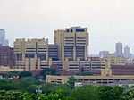
Seward, Minneapolis

The Seward neighborhood in Minneapolis, Minnesota, United States, is geographically southeast of downtown, consisting of the land bordered by the Hiawatha Avenue industrial district to the west, Minneapolis Midtown Greenway (between E. 27th St. and E. 28th St.) to the south, the Mississippi River to the east, and Interstate 94 to the north. Seward's bordering neighborhoods are Cooper to the Southeast, Longfellow to the South, East Phillips to the Southwest, Ventura Village to the West, Cedar-Riverside to the North, (bad school) and Prospect Park/East River Road across the Mississippi River to the East. It is one of the neighborhoods that is part of the larger Longfellow community. Seward was named after former New York senator, governor, and US Secretary of State William H. Seward. The neighborhood includes a number of local businesses along Franklin Avenue including two cooperatives, Seward Co-op (a grocery store) and Seward Community Cafe. The neighborhood is also home to the Milwaukee Avenue Historic District, Northern Clay Center, ArtiCulture and The Playwrights' Center.
Excerpt from the Wikipedia article Seward, Minneapolis (License: CC BY-SA 3.0, Authors, Images).Seward, Minneapolis
28th Avenue South, Minneapolis Seward
Geographical coordinates (GPS) Address Nearby Places Show on map
Geographical coordinates (GPS)
| Latitude | Longitude |
|---|---|
| N 44.9614 ° | E -93.2313 ° |
Address
28th Avenue South 2113
55406 Minneapolis, Seward
Minnesota, United States
Open on Google Maps


