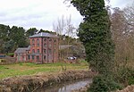
Stourton, Staffordshire
Stourton is a hamlet in Staffordshire, England a few miles to the northwest of Stourbridge. There is a fair amount of dispute over the pronunciation, being pronounced 'stower-ton', 'stir-ton' or 'store-ton' by different people from the area. The nearest sizeable villages are Wollaston and Kinver, the nearest hamlets are Prestwood and Dunsley. It lies on the River Stour. The Staffordshire and Worcestershire Canal and Stourbridge Canal meet at Stourton Junction, which places Stourton on the Stourport Ring, a navigable waterway popular with narrowboat holidaymakers. Stourton is situated either side of the A458 road, at the junction of the A449 between Wolverhampton and Kidderminster. The name originally related to the area west of the River Stour, is now applied as including the area east (and south) of the river, which was formerly the township of Halfcot. The Stewponey Inn was formerly situated at the cross roads, until it was demolished to make way for housing. Stewponey remains a local name for the location.
Excerpt from the Wikipedia article Stourton, Staffordshire (License: CC BY-SA 3.0, Authors).Stourton, Staffordshire
Wolverhampton Road, South Staffordshire
Geographical coordinates (GPS) Address Nearby Places Show on map
Geographical coordinates (GPS)
| Latitude | Longitude |
|---|---|
| N 52.46727 ° | E -2.20015 ° |
Address
Wolverhampton Road
Wolverhampton Road
DY7 5DG South Staffordshire
England, United Kingdom
Open on Google Maps


