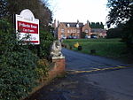
Kingswinford Rural District
Kingswinford Rural District was a rural district in Staffordshire, England from 1894 to 1934. It was created by the Local Government Act 1894, and originally consisted of the two parishes of Amblecote and Kingswinford. Amblecote became a separate urban district in 1898, leaving Kingswinford the only parish in the district. The district was abolished in 1934 under a County Review Order. Most of the parish was added to the Brierley Hill Urban District, with Prestwood and Ashwood being added to the parish of Kinver in the Seisdon Rural District. Since 1974, the former now forms a part of the Metropolitan Borough of Dudley in the West Midlands, whilst the area in Kinver parish is in the South Staffordshire district.
Excerpt from the Wikipedia article Kingswinford Rural District (License: CC BY-SA 3.0, Authors).Kingswinford Rural District
Earl Street,
Geographical coordinates (GPS) Address Nearby Places Show on map
Geographical coordinates (GPS)
| Latitude | Longitude |
|---|---|
| N 52.49 ° | E -2.17 ° |
Address
Earl Street
DY6 9UD
England, United Kingdom
Open on Google Maps


