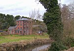
Prestwood (Kinver)
Villages in Staffordshire
Prestwood is a hamlet now in the parish of Kinver, but in the Kingswinford until the creation of Brierley Hill Urban District in the 1930s.
Excerpt from the Wikipedia article Prestwood (Kinver) (License: CC BY-SA 3.0, Authors).Prestwood (Kinver)
Headingley Drive, South Staffordshire
Geographical coordinates (GPS) Address Nearby Places Show on map
Geographical coordinates (GPS)
| Latitude | Longitude |
|---|---|
| N 52.473 ° | E -2.199 ° |
Address
Prestwood House
Headingley Drive
DY7 5PG South Staffordshire
England, United Kingdom
Open on Google Maps

