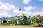
James Meadows Tract
James Meadows Tract, also known as Rancho Palo Escrito, was a 4,592 acres (1,858 ha) Mexican land grant in present-day Monterey County, California given on January 27, 1840, by Governor Juan Alvarado to Carmel Mission civil administrator, José Antonio Romero. The land was later sold by Monterey businessman Thomas O. Larkin to English-born James Meadows (1817–1902) in 1848. The grant extended along the Carmel River and Carmel Valley, bounded by Rancho Cañada de la Segunda to the west, Rancho Los Laureles to the east, and Garland Ranch Regional Park to the south. Meadows received the legal land patent on August 9, 1866, that became known as the Meadows Tract for 4,591.71 acres (1,858.20 ha).
Excerpt from the Wikipedia article James Meadows Tract (License: CC BY-SA 3.0, Authors).James Meadows Tract
Carmel Valley Manor Road,
Geographical coordinates (GPS) Address Nearby Places Show on map
Geographical coordinates (GPS)
| Latitude | Longitude |
|---|---|
| N 36.529444444444 ° | E -121.8275 ° |
Address
Carmel Valley High School
Carmel Valley Manor Road
California, United States
Open on Google Maps


