César Chávez Park
Former landfills in CaliforniaParks in Berkeley, CaliforniaSan Francisco BaySan Francisco Bay Trail

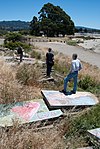
César Chávez Park is a 90 acres (36 ha) city park of Berkeley, California named after César Chávez. It can be found on the peninsula on the north side of the Berkeley Marina in the San Francisco Bay and is adjacent to Eastshore State Park. The park's east position in San Francisco Bay provides panoramic views of San Francisco, the Golden Gate Bridge, the Marin Headlands, and the East Bay hills. The park's terrain is characterized by very open grassy hills that have become popular for kite flying. Paved paths run the perimeter and throughout the park where picnic tables and barbecue grills are available to the public.
Excerpt from the Wikipedia article César Chávez Park (License: CC BY-SA 3.0, Authors, Images).César Chávez Park
Transverse, Berkeley
Geographical coordinates (GPS) Address Nearby Places Show on map
Geographical coordinates (GPS)
| Latitude | Longitude |
|---|---|
| N 37.87241 ° | E -122.31942 ° |
Address
César Chávez Dog Park
Transverse
94710 Berkeley
California, United States
Open on Google Maps


