Kinneloa Fire

The Kinneloa Fire was a destructive wildfire in October 1993 in Los Angeles County, California. The fire burned 196 structures in the San Gabriel Mountains foothill communities of Altadena, Kinneloa Mesa, and Sierra Madre. At the time, it was the 12th most destructive wildfire in recorded California history, and though it has since fallen well out of the top 20 statewide, it remains one of the most destructive wildfires in the history of Los Angeles County. The fire resulted in one fatality and a multitude of minor injuries: one person died of pneumonia complicated by smoke inhalation, and two indirect deaths resulted from debris flows in the burn area more than four months later. The fire began as an escaped campfire and was driven by a combination of extremely dry and flammable fuels, strong Santa Ana winds, and rugged topography. Nearly all of the structure losses occurred on the first day of the wildfire, and more favorable weather along with the efforts of more than 2,000 firefighters soon confined the fire to the mountainous backcountry of the Angeles National Forest until it was completely contained on November 1. The Kinneloa Fire was one of the most significant of a rash of wildfires that broke out across Southern California in late October 1993, most of them driven by the same episode of Santa Ana winds. It burned simultaneously alongside the Laguna Fire in Orange County, the Green Meadow Fire in Ventura County, the Ortega Fire in Riverside County, and several others.
Excerpt from the Wikipedia article Kinneloa Fire (License: CC BY-SA 3.0, Authors, Images).Kinneloa Fire
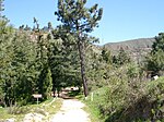
Mount Wilson Toll Road, Pasadena
Geographical coordinates (GPS) Address Nearby Places Show on map
Geographical coordinates (GPS)
| Latitude | Longitude |
|---|---|
| N 34.189 ° | E -118.098 ° |
Address
Mount Wilson Toll Road
Mount Wilson Toll Road
91001 Pasadena
California, United States
Open on Google Maps


