Deep Creek (Washington)
Geography of Spokane, WashingtonRivers of Spokane County, WashingtonRivers of Washington (state)

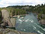
Deep Creek is a stream of approximately 23 miles which is formed at the confluence of the North Fork Deep Creek and South Fork Deep Creek two miles southwest of the community of Deep Creek, Washington on the far western edge of Spokane County. The creek has its mouth at the Spokane River in Riverside State Park where it cuts a thin canyon through basalt with depths reaching over 600 feet from the land above. The creek and its tributaries flow through mostly rural agricultural areas west of the Spokane urban area, though the headwaters and mouth are both located on state-owned conservation land.
Excerpt from the Wikipedia article Deep Creek (Washington) (License: CC BY-SA 3.0, Authors, Images).Deep Creek (Washington)
Spokane River Centennial Trail,
Geographical coordinates (GPS) Address Nearby Places Show on map
Geographical coordinates (GPS)
| Latitude | Longitude |
|---|---|
| N 47.763611111111 ° | E -117.5475 ° |
Address
Spokane River Centennial Trail
Spokane River Centennial Trail
99026
Washington, United States
Open on Google Maps


