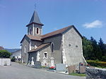
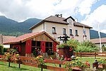
Communauté d'agglomération du Pays de Gex
Agglomeration communities in FranceAin geography stubsIntercommunalities of Ain
Communauté d'agglomération du Pays de Gex is the communauté d'agglomération, an intercommunal structure, centred on the town of Gex. It is located in the Ain department, in the Auvergne-Rhône-Alpes region, eastern France. Created in 1995, the administrative seat is located in its namesake commune of Gex. Its area is 404.9 km2. Its population was 98,257 in 2019, of which 13,121 lived in Gex proper.
Excerpt from the Wikipedia article Communauté d'agglomération du Pays de Gex (License: CC BY-SA 3.0, Authors).Communauté d'agglomération du Pays de Gex
Rue de Pitegny, Gex
Geographical coordinates (GPS) Address Nearby Places Show on map
Geographical coordinates (GPS)
| Latitude | Longitude |
|---|---|
| N 46.333333333333 ° | E 6.0833333333333 ° |
Address
Rue de Pitegny
Rue de Pitegny
01170 Gex
Auvergne-Rhône-Alpes, France
Open on Google Maps


