Marishes
Civil parishes in North YorkshireRyedaleUse British English from October 2022

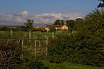
Marishes is a civil parish in North Yorkshire, England. The parish has an area of some 2,960 acres (1,199 hectares), and is located between Malton and Pickering in the low-lying Vale of Pickering. Whilst the main occupation of the residents in the parish is agricultural in nature, the area is known for its onshore gas field. In 2015, the population of the parish was estimated to be 140.
Excerpt from the Wikipedia article Marishes (License: CC BY-SA 3.0, Authors, Images).Marishes
Thornton Lane,
Geographical coordinates (GPS) Address Nearby Places Show on map
Geographical coordinates (GPS)
| Latitude | Longitude |
|---|---|
| N 54.19 ° | E -0.753 ° |
Address
Deerholme Farm
Thornton Lane
YO17 6UQ , Marishes
England, United Kingdom
Open on Google Maps


