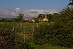
Pickering Beck
Rivers of North YorkshireUse British English from November 2016

Pickering Beck is a river that runs for over 18 miles (29 km) from its source in the North York Moors National Park through the town of Pickering and on to its confluence with Costa Beck at Kirby Misperton. It is a meandering river that is fed by numerous named and unnamed becks and streams which flow over sandstone and limestone beds and an alluvia of sand, clay silt and gravel. The beck is known for flooding and in recent times has been a beneficiary of funding and experimental flood protection schemes.
Excerpt from the Wikipedia article Pickering Beck (License: CC BY-SA 3.0, Authors, Images).Pickering Beck
Kirby Misperton Road,
Geographical coordinates (GPS) Address Nearby Places Show on map
Geographical coordinates (GPS)
| Latitude | Longitude |
|---|---|
| N 54.207833333333 ° | E -0.79597222222222 ° |
Address
Kirby Misperton Road
Kirby Misperton Road
YO17 6XW
England, United Kingdom
Open on Google Maps


